Updated
Europe’s strangest scenery rarely sits on the famous postcard routes. Some of it lies in a dry corner of Andalucía where gullies of clay run for kilometres, some on a Bulgarian plain where stone columns rise out of the sand, and some in the Icelandic interior, where the mountains are streaked yellow, green and rust. Each looks unreal for a sound geological reason.
This guide picks eight surreal natural landscapes in Europe that are still relatively little photographed, with what makes each one odd, how to reach it and how to visit without damaging it. Several are fragile, so the rule that runs through all of them is simple: stay on the marked paths.
Surreal landscapes at a glance
- Best for desert scenery: the Gorafe badlands in Andalucía and the calanchi around Aliano in Basilicata.
- Best for colour: Landmannalaugar in Iceland and the red Río Tinto in Huelva.
- Best for strange rock shapes: Ciudad Encantada near Cuenca, the Euseigne pyramids in Switzerland and Pobiti Kamani near Varna.
- Best with history: Las Médulas, a mountain reshaped by Roman gold miners.
- Getting there: almost all need a car or an organised tour; Euseigne is on a regular bus route.
- When to go: spring and autumn in southern Europe; late June to early September for the Icelandic highlands.
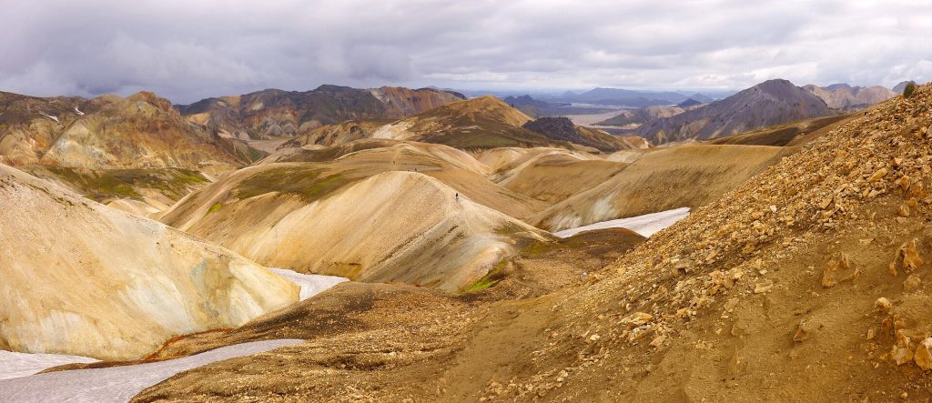
1. Landmannalaugar, Iceland
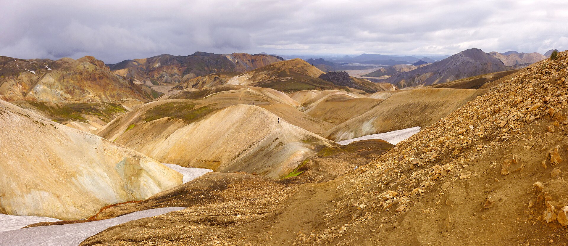
Landmannalaugar, in the Fjallabak Nature Reserve, sits among rhyolite mountains whose minerals colour the slopes in ochre, pale green, pink and charcoal. Right behind the huts, the Laugahraun lava field is a jumble of black obsidian that erupted in the late 15th century from a fissure running through the mountain Brennisteinsalda. The hot spring that gives the place its name, roughly “the people’s pools”, rises at the edge of that lava.
The easiest walk climbs through Laugahraun to Brennisteinsalda and back, a loop of a few hours. Near the steam vents the ground is thin and hot, so keep strictly to the trail.
Access is by highland roads open only in summer, usually from some time in June, and they require a 4×4; some approaches also involve river crossings. Most visitors without experience of fording rivers take a highland bus or a tour. Parking is paid and booked in advance; check current rules before you go.
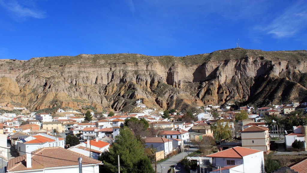
2. The Gorafe badlands, Spain
North-east of Granada, between Guadix and Baza, the land drops into a maze of ravines cut through pale clays and conglomerates. This is the Gorafe “desert”, part of the Granada Geopark, which was designated a UNESCO Global Geopark in 2020. The sediments were laid down in an ancient basin, and once the rivers began draining to the sea they carved the soft deposits into ridges, gullies and isolated towers.
The area also holds one of the largest concentrations of prehistoric tombs in Europe: more than 240 Neolithic dolmens spread across ten necropolises in the Gorafe Megalithic Park. The village of Gorafe has an interpretation centre, and signed routes link the dolmen groups with viewpoints over the badlands.
Tracks through the desert are unpaved and can be rough after rain; a standard car manages the main ones with care. There is no shade, so avoid midday in summer and carry plenty of water.
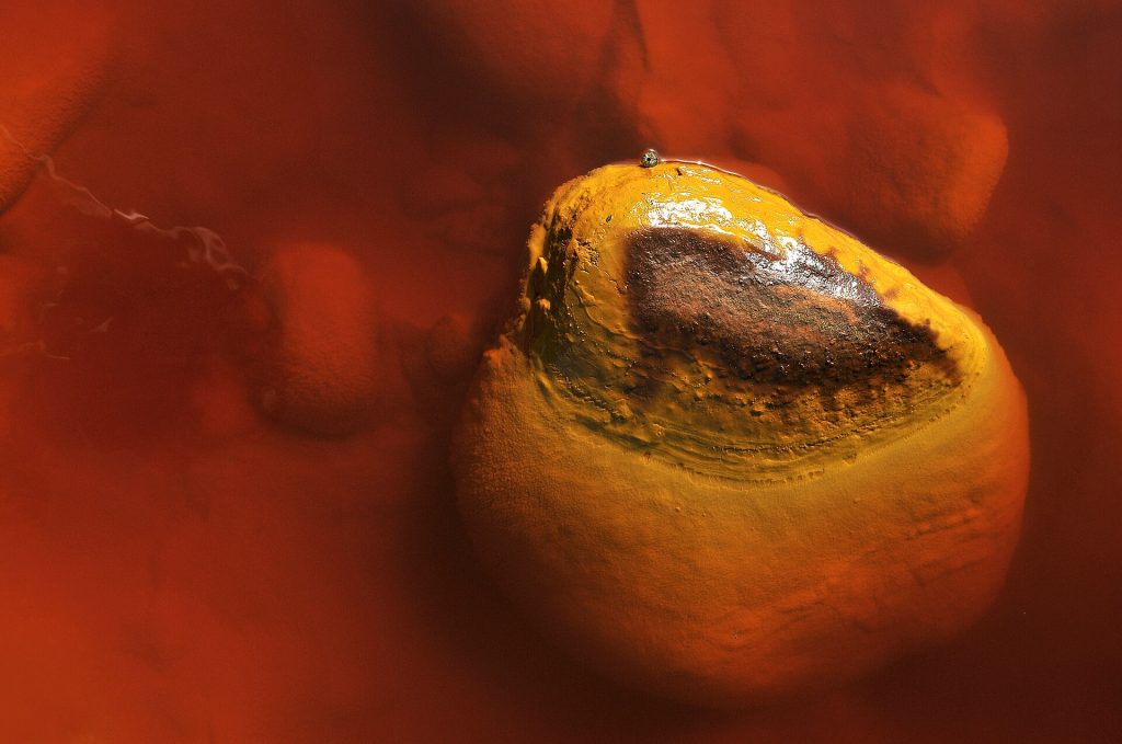
3. Río Tinto, Spain
In the hills of Huelva province the Río Tinto runs red, orange and sometimes wine-dark over banks crusted with yellow and ochre minerals. The water is strongly acidic, with a pH around 2, and rich in dissolved iron. Mining has gone on here since antiquity, but the acidic conditions are older than human activity, driven by microbes living off the vast sulphide deposits underground. Because the chemistry resembles minerals found on Mars, scientists, including teams working with NASA, have used the river as a Mars analogue.
The easiest way in is the Riotinto Mining Park at Minas de Riotinto. It includes a mining museum, a tourist railway that follows the river, the Peña de Hierro mine and a viewpoint over Corta Atalaya, an enormous open pit. The train and the pit need a timed booking.
Do not drink, swim in or paddle in the water, and stay out of old mine workings, which can be unstable.
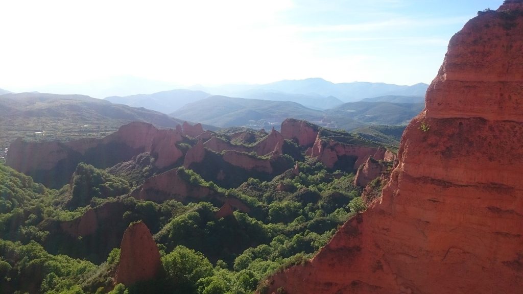
4. Las Médulas, Spain
In El Bierzo, in the province of León, sharp orange peaks rise above chestnut woods. They look natural, but they are what is left of the largest gold mine in the Roman Empire. Roman engineers channelled water into tunnels dug through the hills until whole slopes collapsed, then washed the debris for gold. Pliny the Elder described the method, known as ruina montium. The site was added to the UNESCO World Heritage List in 1997.
The classic view is from the Mirador de Orellán, close to the Galería de Orellán, one of the old Roman tunnels that visitors can enter. Walking trails run from the village of Las Médulas to the base of the pinnacles.
A large wildfire in August 2025 burned much of the surrounding woodland, and restoration work has been under way since. The rock formations remain, but some trails and facilities may be closed or changed; check with the local visitor centre before planning a walk.
5. Ciudad Encantada, Spain
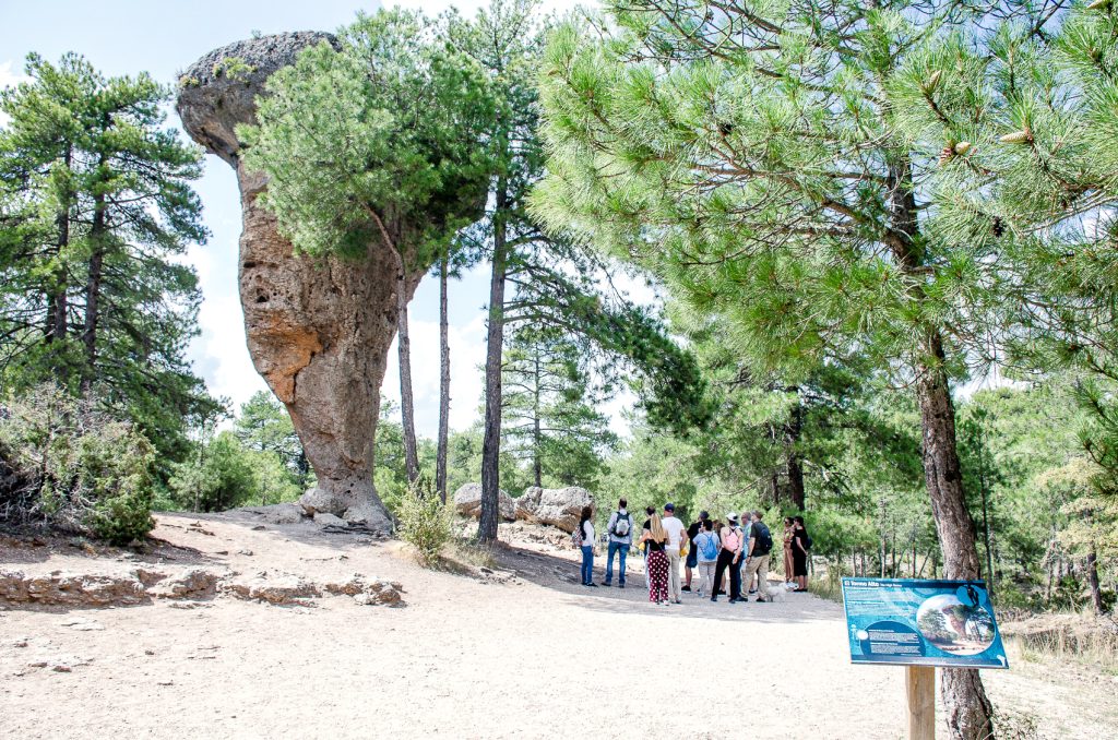
The “Enchanted City” sits in pine woods in the Serranía de Cuenca, around 30 km by road from the city of Cuenca. Rain and frost worked on a plateau of limestone and dolomite laid down about 90 million years ago; the softer limestone wore away faster than the dolomite, leaving mushrooms, arches, narrow streets and blocks that look like ships or faces. It was declared a protected natural site in 1929.
A marked circular path of about 3 km leads past the named formations, such as the Tormo Alto, a slim pillar balanced on a narrow base, and Los Barcos. Allow around an hour and a half. There is an entry fee, and the path is easy enough for most ages.
Do not climb on the formations or carve into the soft rock.
6. Pyramids of Euseigne, Switzerland
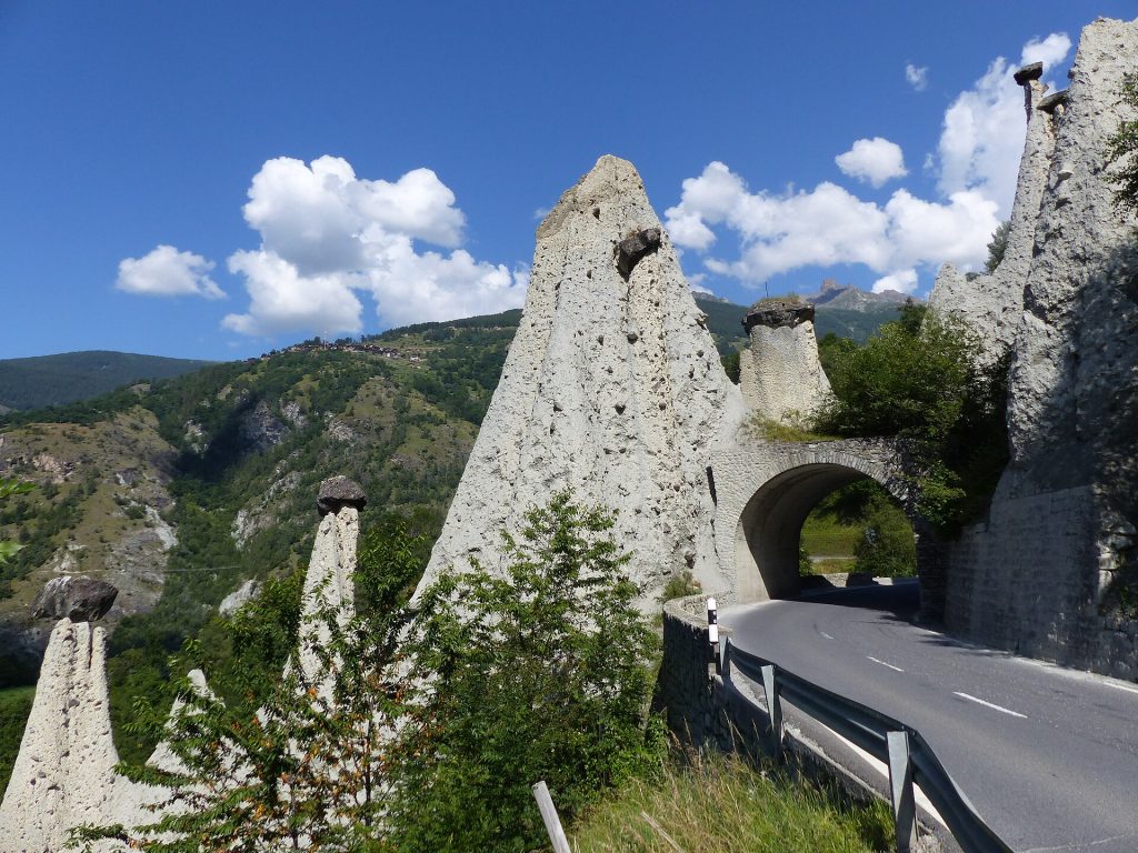
On the road from Sion into the Val d’Hérens in Valais, a cluster of pale columns stands above the tarmac, each with a boulder balanced on top. These earth pyramids formed in glacial moraine left behind after the last ice age. Where a large stone protected the sediment beneath it from rain, a pillar survived while the surrounding material washed away. The tallest reach roughly 10 to 15 metres, and the road passes through a short tunnel cut beneath them.
The site is on the Federal Inventory of Swiss landscapes of national importance. Postbuses from Sion to Evolène stop at Euseigne, which makes this one of the few places on the list you can reach easily without a car. A short path leads to viewpoints. The pillars are crumbly, so do not scramble up the slopes or dislodge the caps.
7. Pobiti Kamani, Bulgaria
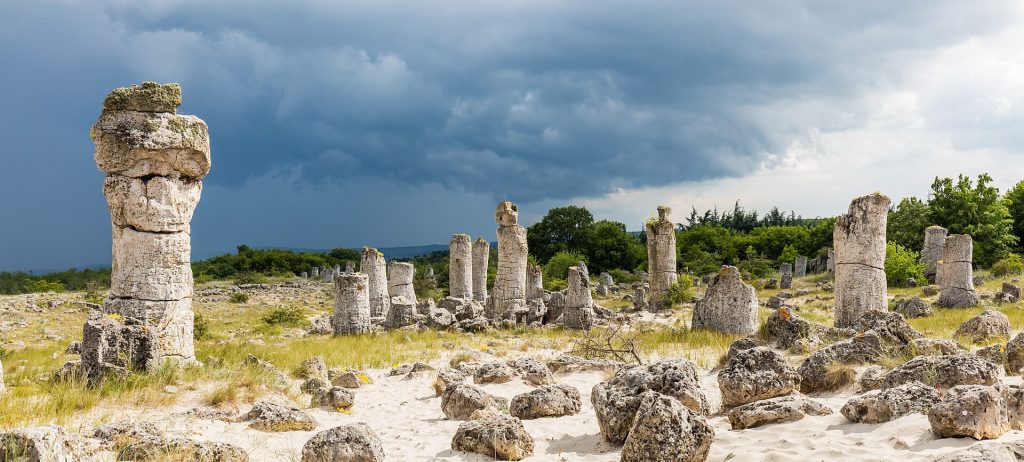
About 18 km west of Varna, on a sandy plain off the old road to Devnya, groups of hollow stone columns stand like the trunks of a petrified wood. Pobiti Kamani means “beaten” or “planted stones”. The columns reach several metres high, up to around 10 metres according to the UNESCO tentative list entry, and some are a couple of metres thick.
Nobody agrees on how they formed. Theories range from sea erosion and wind to fossil reefs; a recent hypothesis links them to ancient seeps of methane gas through sandy sediments. The site has been protected since the 1930s and has been on Bulgaria’s tentative list for World Heritage.
The largest group, known as Centre-South, has a small entrance area and paths between the columns. It is an easy half day from Varna or the Black Sea resorts, best early or late when the sand is not too hot. Stay on the paths, as the sand ecosystem is protected.
8. The calanchi of Aliano, Italy
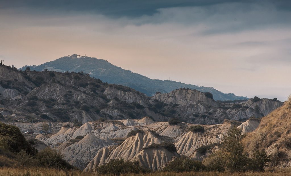
In inland Basilicata, between the Agri and Sauro valleys, rain has cut grey clay hills into knife-edge ridges and deep furrows, known in Italian as calanchi. Aliano sits on a clay spur right at the edge of them. The writer Carlo Levi spent part of his internal exile here in the 1930s, described the village as Gagliano in Christ Stopped at Eboli, and chose to be buried in its cemetery.
Marked trails in the Calanchi Park around Aliano lead out along the ridges, including one dedicated to Levi, and there is a longer cycling loop. The clay is soft and can collapse at the edges, so keep to the path and avoid walking out after heavy rain, when it turns to slick mud. Many visitors pair Aliano with the abandoned hilltop village of Craco, or with Matera.
Already covered elsewhere, in brief
- Bardenas Reales, Navarre: the best-known Spanish badlands, with the Castildetierra butte.
- Đavolja Varoš, Serbia: more than 200 earth pyramids on the slopes of Radan mountain.
- Earth pyramids of Ritten, South Tyrol: slender capped pillars above Bolzano.
- Zumaia, Basque Country: tilted flysch strata exposed along the cliffs at low tide.
- Słowiński National Park, Poland: shifting dunes between the Baltic and Lake Łebsko.
- Cappadocia: the fairy chimneys from the original article, though they lie in Asian Turkey.
Visiting fragile landscapes responsibly
Badlands, earth pyramids and soft limestone erode quickly enough that footsteps matter: a cap stone knocked off an earth pyramid exposes the pillar to rain. Keep to marked paths, do not climb formations, and fly drones only where the rules allow; protected areas often ban them.
- Heat and water: Gorafe, Río Tinto and Aliano can be very hot in July and August. Walk early and carry more water than you expect to need.
- After rain: clay tracks in badlands become slippery and some are impassable by car.
- Highland roads: in Iceland, check road status on the official road administration site before setting out, and never cross a river you are unsure about.
- Check current access: fees, booking slots and trail closures change, especially at Las Médulas and Landmannalaugar.
Plan your trip
- Iceland: tickets and tours on Tiqets · activities on Klook
- Spain: tickets and tours on Tiqets · activities on Klook
- Switzerland: tickets and tours on Tiqets · activities on Klook
- Arriving by plane: pre-book an airport transfer with Welcome Pickups
- Road trip: compare car hire on Localrent
- Mobile data: get a travel eSIM from Airalo
Some of these are affiliate links: if you book through them we may earn a small commission, at no extra cost to you.
Planning a bigger trip? See our guide to the 25 best places to visit in Europe, from city breaks to fjords.
Keep exploring
- Volcanic Wine Regions in Europe: 9 Vineyard Landscapes to Visit
- 10 European Landscapes Worth a Whole Trip
- Winter Wonderlands in Europe: 7 Snowy Landscapes to See
Frequently asked questions
Does Europe have real deserts?
Not in the strict climatic sense, but southern Spain comes close. The badlands of Gorafe, the Tabernas area of Almería and the Bardenas Reales in Navarre are semi-arid, with sparse vegetation and eroded clay scenery that looks like a desert.
What are earth pyramids?
Pillars of soft sediment, often glacial moraine, protected from rain by a hard stone on top. The stone shields the material below while the surrounding slope washes away. Euseigne, Ritten and Đavolja Varoš are well-known European examples.
Can you swim in the Río Tinto?
No. The water is strongly acidic and carries dissolved metals, so it is not safe for swimming or drinking. View it from the banks, the viewpoints or the tourist train.
Photos: Borvan53, CC BY-SA 4.0, via Wikimedia Commons; Falconaumanni, CC BY-SA 3.0, via Wikimedia Commons; LBM1948, CC BY-SA 4.0, via Wikimedia Commons; Sammy pompon, CC BY-SA 3.0 es, via Wikimedia Commons; MottaW, CC BY-SA 4.0, via Wikimedia Commons; Whgler, CC BY-SA 4.0, via Wikimedia Commons; Diego Delso, CC BY-SA 4.0, via Wikimedia Commons; Sabryardore, CC BY-SA 4.0, via Wikimedia Commons.