Updated
Spain has two big island groups and they could hardly be more different. The Balearics sit in the Mediterranean, a short hop from Barcelona and Valencia, with pine-backed coves and a classic summer season. The Canaries lie in the Atlantic off north-west Africa, volcanic and mild all year. Most visitors only see the large, famous islands.
This guide is about the others: six smaller or less visited Spanish islands that reward the extra ferry ride, including one off Galicia that belongs to neither group. The big names follow in a line each, then a short section on choosing between the archipelagos.
Spanish islands at a glance
- Best for hiking: La Gomera, La Palma and El Hierro, all reached via Tenerife.
- Best for beaches without high-rises: Formentera, La Graciosa and the Cíes Islands.
- Best for winter sun: any of the Canaries.
- Best for a Mediterranean summer: Formentera, Menorca and Mallorca, roughly June to September.
- Plan ahead: the Cíes Islands need a free advance authorisation in high season.
1. El Hierro: the far edge of the Canaries
El Hierro is the smallest and most westerly of the main Canary Islands, and the capital, Valverde, feels like a village. Europeans once treated its western tip as the end of the known world, and some old maps drew their prime meridian through it. There are no big resorts, few sandy beaches and almost no nightlife.
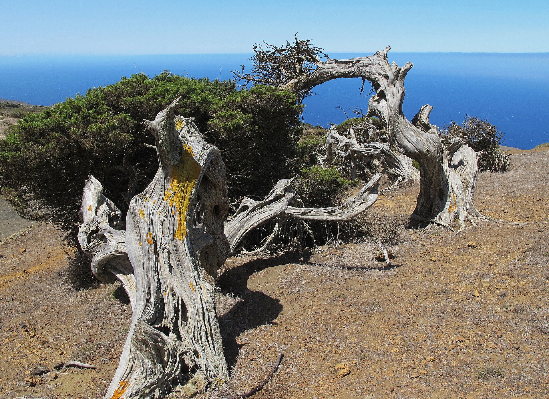
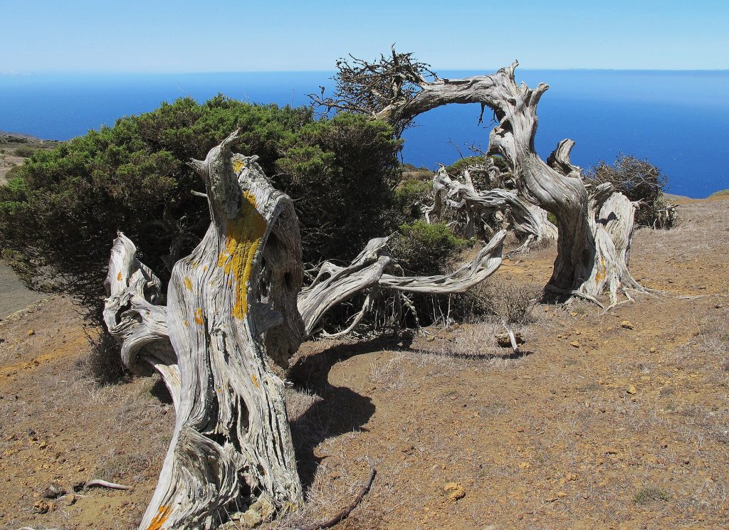
The highest point, Malpaso, reaches 1,501 metres, and the GR 131 path climbs to it from sea level. On the windswept western plateau, the junipers of El Sabinar grow almost sideways. The great curved bay of El Golfo, seen from the Mirador de la Peña designed by César Manrique, is the classic view. Swimming happens in natural rock pools such as Charco Azul, and at La Restinga in the south, beside the Mar de las Calmas marine reserve, divers come for some of the clearest water in Spain.
The island became a UNESCO Biosphere Reserve in 2000 and is also a UNESCO Global Geopark. Its Gorona del Viento station pairs wind turbines with a pumped water reservoir to supply much of the island’s electricity. Allow at least three nights; the ferry from Los Cristianos in Tenerife takes about two and a half hours, and short flights run from Tenerife North and Gran Canaria.
2. La Gomera: Garajonay’s laurel forest
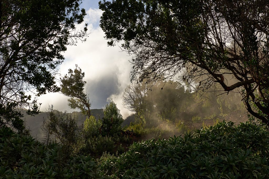
La Gomera is almost round, and from its central plateau deep ravines, or barrancos, run down to the sea like spokes. Roads twist along their sides, so short distances take a long time to drive. That terrain kept mass tourism away and makes the island superb for walking.
Its heart is Garajonay National Park, on the UNESCO World Heritage list since 1986. It protects one of the best surviving areas of laurisilva, the humid laurel forest that once covered much of southern Europe. Trade-wind cloud drifts through the moss-hung trees most afternoons. A short path leads to the Alto de Garajonay, at 1,487 metres the island’s highest point, with views to Teide when the cloud clears.
The island is also known for Silbo Gomero, a whistled form of Spanish once used to send messages across the ravines, added to UNESCO’s intangible heritage list in 2009. Valle Gran Rey on the west coast is the main base, with black-sand beaches and terraced palm groves; Hermigua and Agulo in the green north are quieter. Ferries from Los Cristianos take around 50 minutes.
3. La Palma: the Caldera and the clearest skies
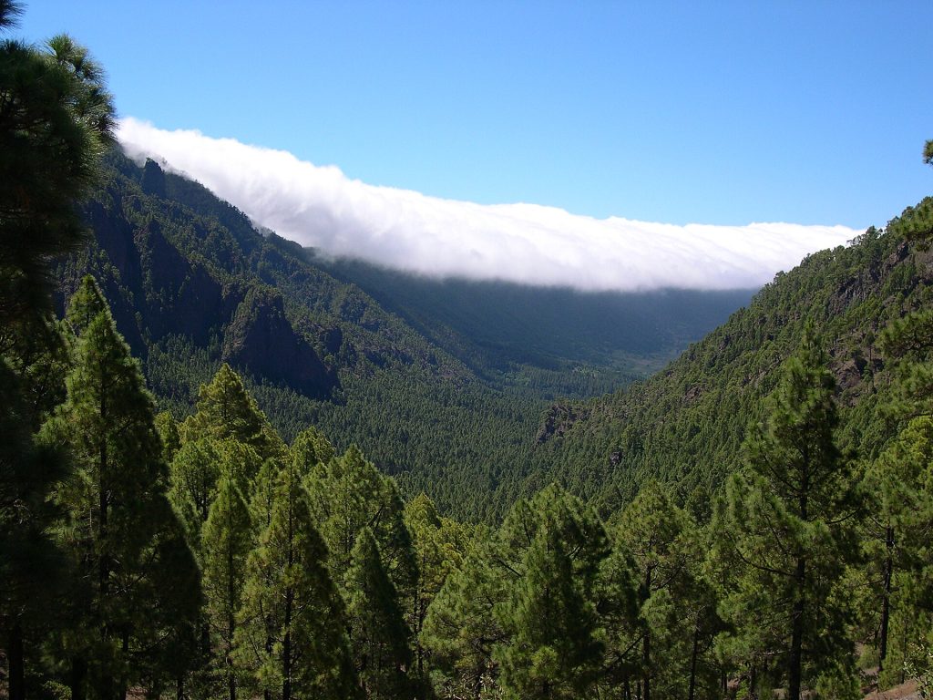
La Palma is steep, green and high. Its northern half is dominated by the Caldera de Taburiente, a vast erosion crater roughly 8 to 10 kilometres across and a national park since 1954. The most popular walk starts with a 4×4 taxi to the Los Brecitos viewpoint and descends through Canary pines to the riverbed. Check with the park visitor centre near El Paso first, as paths close after heavy rain.
On the northern rim, the Roque de los Muchachos reaches 2,426 metres, and the summit road passes the domes of a major astronomical observatory, sited here for the clean air and strict controls on light pollution. Stargazing tours run from several villages.
In 2021, a volcanic eruption on the Cumbre Vieja ridge lasted 85 days, from mid-September to mid-December. Lava flowed down the western slope to the sea, covering homes, banana plantations and roads. The island has been rebuilding since, visitors are welcome, and guided walks now visit the new cone, named Tajogaite. Follow local guidance, as some areas remain restricted.
4. La Graciosa: sand streets off Lanzarote
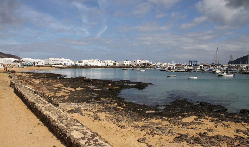
Across a narrow strait from the northern tip of Lanzarote, La Graciosa was recognised as the Canaries’ eighth inhabited island in a 2018 reform of the regional Statute of Autonomy, though it is still administered from Lanzarote. Almost everyone lives in Caleta de Sebo, a harbour village of low white houses where the streets are simply sand.
There are no paved roads and visitors cannot bring cars, so people walk, hire bicycles or use the licensed 4×4 taxis. The island lies within the protected Chinijo Archipelago, a landscape of volcanic cones, pale sand and very clear sea. Playa Francesa, south-west of the village, suits an easy swim. The wild Playa de las Conchas on the north-west coast is the most photographed beach, but currents can be strong, so take care.
Ferries from Órzola take about 25 minutes and run many times a day. Staying a night means you see the island after the day visitors leave.
5. Formentera: the flat, quiet Balearic
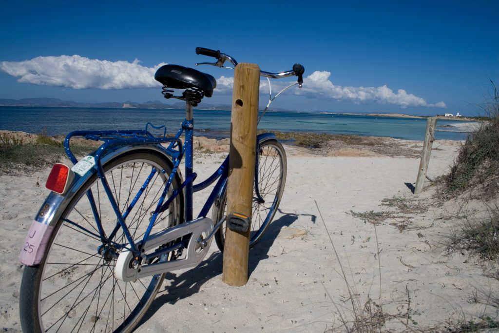
Formentera is the smallest of the four main Balearic Islands and has no airport, so everyone arrives by boat from Ibiza Town. That keeps it calmer than its neighbour. The island is flat apart from the plateau of La Mola in the east, and quiet lanes make it easy to explore by bicycle.
The draw is the water. Ses Illetes, a thin sandy spit pointing towards Ibiza, lies inside the Ses Salines Natural Park and has some of the palest turquoise sea in the Mediterranean. Its clarity owes much to the Posidonia seagrass meadows between the two islands, part of the Ibiza, Biodiversity and Culture World Heritage Site inscribed in 1999. For a change from beaches, ride out to the cliff-top lighthouses at Cap de Barbaria or La Mola.
The island limits vehicle numbers in peak season, and access to some areas, including Cap de Barbaria, has been regulated in summer, so check current rules before taking a car across. Go in June or September for warm water without the August crowds.
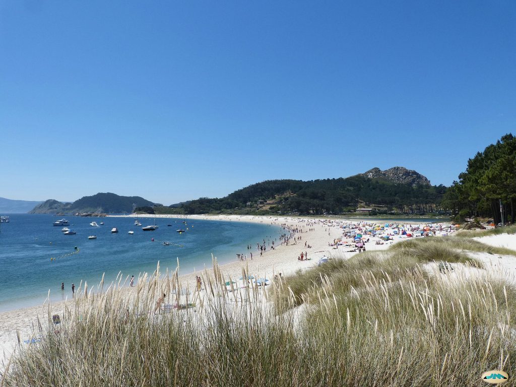
6. The Cíes Islands: Galicia’s Atlantic outpost
Off the mouth of the Ría de Vigo, the three Cíes Islands form part of the Atlantic Islands of Galicia National Park, created in 2002. Two of them, Monteagudo and Do Faro, are joined by Rodas beach, a curve of fine white sand backed by a calm lagoon.
Paths climb through pine woods to the Faro de Cíes lighthouse and the Alto do Príncipe viewpoint above the seabird cliffs on the western side. The water is clear but Atlantic cold, even in August. There are no cars, and the only accommodation is a campsite.
Visitor numbers are capped. In high season, roughly Easter and mid-May to the end of September, apply online for a free authorisation from the Xunta de Galicia before buying a ferry ticket. Boats run from Vigo, Cangas and Baiona. Take your rubbish back with you.
The better-known islands in brief
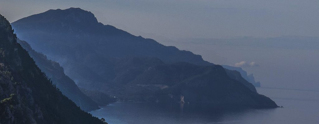
- Mallorca: the largest Balearic island, with the city of Palma, the mountain villages of the Serra de Tramuntana and hundreds of beaches.
- Menorca: calmer and greener, with sheltered coves and prehistoric Talayotic monuments; a strong family choice.
- Ibiza: famous for its clubs, but also the walled Dalt Vila old town and the ferry to Formentera.
- Tenerife: Mount Teide, year-round warmth and the ferry port for La Gomera and El Hierro.
- Gran Canaria: the Maspalomas dunes in the south and mountain scenery around Roque Nublo.
- Lanzarote: the Timanfaya lava fields, César Manrique’s buildings and vines grown in black ash at La Geria.
- Fuerteventura: the longest beaches in the Canaries and steady winds for kitesurfing.
Balearics or Canaries: how to choose
Season decides most trips. The Balearics are a summer destination, with the warmest sea from July to September, and many hotels on the smaller islands close or scale down in winter. The Canaries work all year, with mild, sunny winter days on the southern coasts, though the high ground on La Palma, La Gomera and El Hierro can be cool and cloudy.
The sea differs too. Mediterranean water is calmer and warmer in summer. The Atlantic around the Canaries stays fresh and often has swell, so check flags and use sheltered beaches or natural pools when waves are up.
Getting there and island hopping
For the western Canaries, fly to Tenerife South and take the ferry from nearby Los Cristianos to La Gomera or El Hierro; La Palma and El Hierro also have inter-island flights. For La Graciosa, fly to Lanzarote and head north to Órzola. Formentera is reached only by sea from Ibiza, and the Cíes Islands by boat from Vigo, which has its own airport.
A hire car makes sense on El Hierro, La Gomera and La Palma, where buses are infrequent. In summer and at Easter, book ferries and island accommodation well ahead, and check timetables, as crossings can be cancelled in rough weather.
Plan your trip
- La Palma: tickets and tours on Tiqets · activities on Klook
- Lanzarote: tickets and tours on Tiqets · activities on Klook
- Galicia: tickets and tours on Tiqets · activities on Klook
- Arriving by plane: pre-book an airport transfer with Welcome Pickups
- Road trip: compare car hire on Localrent
- Mobile data: get a travel eSIM from Airalo
Some of these are affiliate links: if you book through them we may earn a small commission, at no extra cost to you.
Planning a bigger trip? See our guide to the 25 best places to visit in Europe, from city breaks to fjords.
Keep exploring
- Spanish Cities You Can’t Miss: 7 Great City Breaks for Food and Fun
- Estonia Adventure Travel: Bogs, Islands, Forest Trails and Saunas
- Europe’s Most Beautiful Islands: 8 Picks by What They Do Best
Frequently asked questions
Which Spanish island is the least touristy?
Among the inhabited islands, El Hierro and La Graciosa see the fewest visitors, with no big resorts and limited accommodation. La Gomera and La Palma are also quiet compared with Tenerife or Mallorca.
Which Spanish islands are best in winter?
The Canary Islands. Tenerife, Gran Canaria, Lanzarote and Fuerteventura have the most reliable beach weather, while La Gomera and La Palma suit hiking in mild temperatures.
Can you visit La Gomera as a day trip from Tenerife?
Yes. Ferries from Los Cristianos take around 50 minutes, and a tour or hire car can cover Garajonay and a viewpoint or two in a day. The slow roads mean you will see much more with at least two nights.
Photos: El Coleccionista de Instantes Fotografía & Video, CC BY-SA 2.0, via Wikimedia Commons; Stefan Koehler MD, CC BY-SA 4.0, via Wikimedia Commons; Luc Viatour, CC BY-SA 3.0, via Wikimedia Commons; Gerd Eichmann, CC BY 4.0, via Wikimedia Commons; Ana Ulin, CC BY-SA 2.0, via Wikimedia Commons; juantiagues, CC BY-SA 2.0, via Wikimedia Commons; Vicenç Salvador Torres Guerola, CC BY-SA 3.0, via Wikimedia Commons.