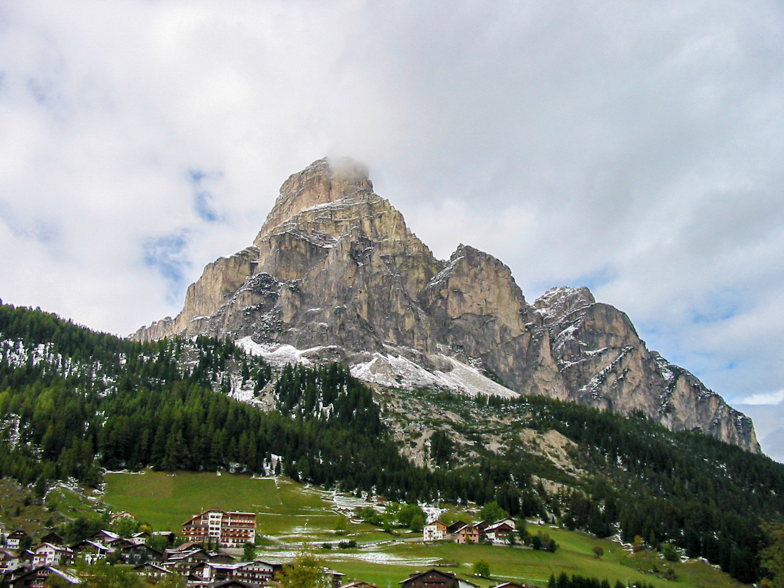
Updated
The Dolomites are the easiest big mountains in Europe to hike well. Lifts save you the dull forest climbs, waymarked paths are numbered on every junction, and staffed huts serve hot lunches at 2,000 metres. The catch is that the famous corners are crowded, several now need advance booking, and summer afternoons often end in thunder.
This guide is built for planning. It sets out the main valley bases, nine named hikes with approximate distance, ascent and difficulty, an overview of the Alta Via 1, and the practical side: season, weather, lifts, hut manners and safety. Figures are approximate, so check a current map before you set off.
Dolomites hiking at a glance
- Season: late June to late September, when most lifts and huts are open; July and August are busiest.
- Best bases: Cortina d’Ampezzo, Val Gardena, Alta Badia, Val di Fassa, Val d’Ega and San Martino di Castrozza.
- Book ahead: the Tre Cime toll road, some lifts in peak season, and huts for July and August.
- Daily rhythm: start early and aim to be off high ground by early afternoon, when storms build.
- Emergency number: 112, across Italy.
Choosing a base
The range spans South Tyrol, Trentino and the Veneto, and driving between valleys over the passes is slow, so pick one or two bases.
- Cortina d’Ampezzo: the largest town, in the Veneto, with the most choice of places to stay. Best for the Tre Cime, Lago di Sorapis and the Cinque Torri.
- Val Gardena: Ortisei, Santa Cristina and Selva, linked by bus and lifts. Best for Seceda, the Sassolungo and the Alpe di Siusi, with Val di Funes a short drive north.
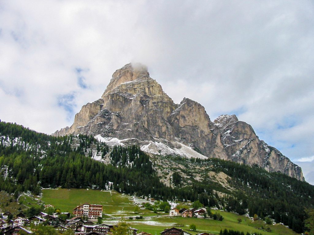
- Alta Badia: Corvara, Colfosco and La Villa, ringed by the Sella, Puez and Sassongher. Climbers use it for the Pisciadù via ferrata above Colfosco.
- Val di Fassa: Canazei and Vigo di Fassa in Trentino, the eastern approach to the Rosengarten and close to the Sella pass.
- Val d’Ega (Eggental): Nova Levante and Nova Ponente, quieter villages under the Latemar and the western Rosengarten, with Lago di Carezza on the road up from Bolzano.
- San Martino di Castrozza: a small resort at the southern edge of the range, directly under the Pale di San Martino.
Around Cortina: Tre Cime, Sorapis and Cinque Torri
1. Tre Cime di Lavaredo circuit
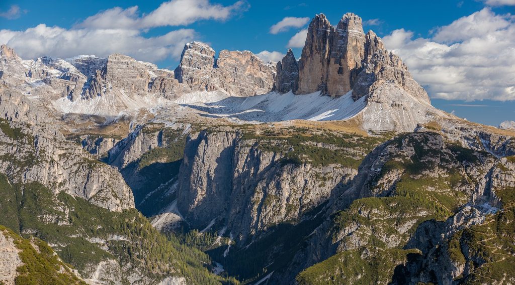
About 10 km, 400 m ascent, 3.5 to 4 hours, easy to moderate. The loop from Rifugio Auronzo at 2,320 metres circles the three towers, passing Rifugio Locatelli, which faces the north walls. A reservation is now required to drive the toll road from near Misurina, and plates are checked at the barrier, so book a time slot well ahead and check current access rules. Walking up from Lago d’Antorno avoids the toll but adds a steady climb.
2. Lago di Sorapis
About 11 km return, 400 m ascent, 4 to 5 hours, moderate. Path 215 leaves Passo Tre Croci, between Cortina and Misurina, and contours through forest to the milky turquoise lake at about 1,925 metres. Several narrow ledges are secured with cables and a short ladder, which unsettles people who dislike drops. The pass car park fills early; buses from Cortina stop there.
3. Cinque Torri open-air museum
About 3 to 5 km, 150 to 250 m ascent, 2 to 3 hours, easy. The five rock towers sat on the Italian line during the First World War, and the trenches, gun positions and tunnels around them have been restored as a free open-air museum. A chairlift from Bai de Dones, on the road to Passo Falzarego, saves the climb; walking up from the car park takes a little over two hours. Bring a head torch for the tunnels.
Val Gardena and Val di Funes: the Odle peaks
4. Seceda and Pieralongia
About 9 km, 450 m ascent, 3 hours, easy to moderate. Reach the 2,519-metre Seceda ridge by the gondola and cable car from Ortisei, where advance booking has been introduced at busy times, or by the Col Raiser gondola from Santa Cristina. A loop links the ridge, the Pieralongia pastures with their pointed rock spur, and Col Raiser. Landowners have charged a small fee at a turnstile near the top viewpoint; check the current situation.
5. Adolf Munkel Trail
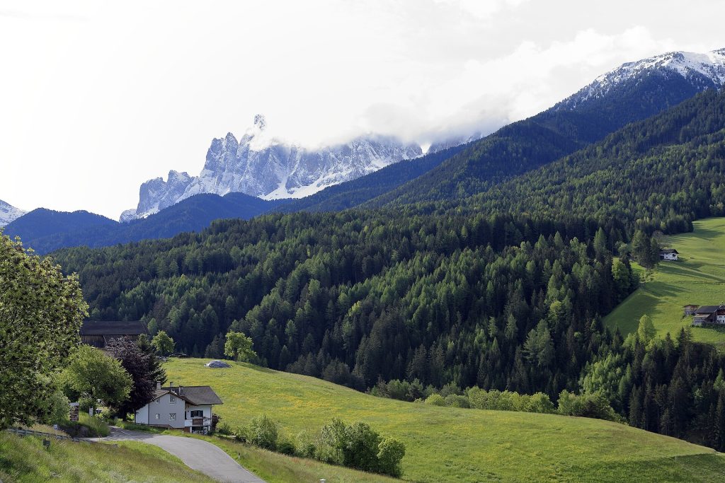
About 9 km, 400 to 450 m ascent, 3 hours, easy to moderate. This loop in the Puez-Odle Nature Park starts at the Zannes car park at the head of Val di Funes and runs along the foot of the Odle north faces, through larch and pine with open views up to the spires, before returning past summer dairy huts.
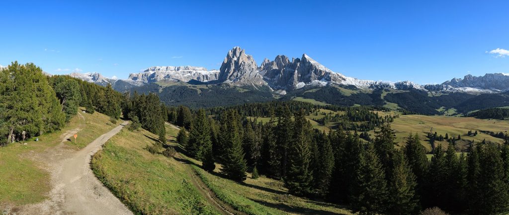
Alpe di Siusi and the Sassolungo
6. Alpe di Siusi
Walks of 5 to 12 km, 100 to 400 m ascent, easy. At about 56 square kilometres, the Alpe di Siusi is often described as Europe’s largest high alpine pasture. The road up is closed to most private cars during the day in the main seasons, so take the gondola from Siusi allo Sciliar to Compaccio, or the lift from Ortisei. Gentle tracks wander between haybarns towards Saltria, with the Sassolungo and Sciliar on the skyline. For a harder day, climb from Compaccio onto the Sciliar plateau, below the summit of Monte Pez.
7. Sassolungo circuit
About 17 km, 700 to 800 m ascent, 5 to 7 hours, moderate. Starting from Passo Sella, this loop goes all the way round the Sassolungo and Sassopiatto, passing the boulder field known as the Città dei Sassi and descending towards the edge of the Alpe di Siusi before climbing back. To shorten it, take the small gondola from Passo Sella to Forcella del Sassolungo and walk down the far side.
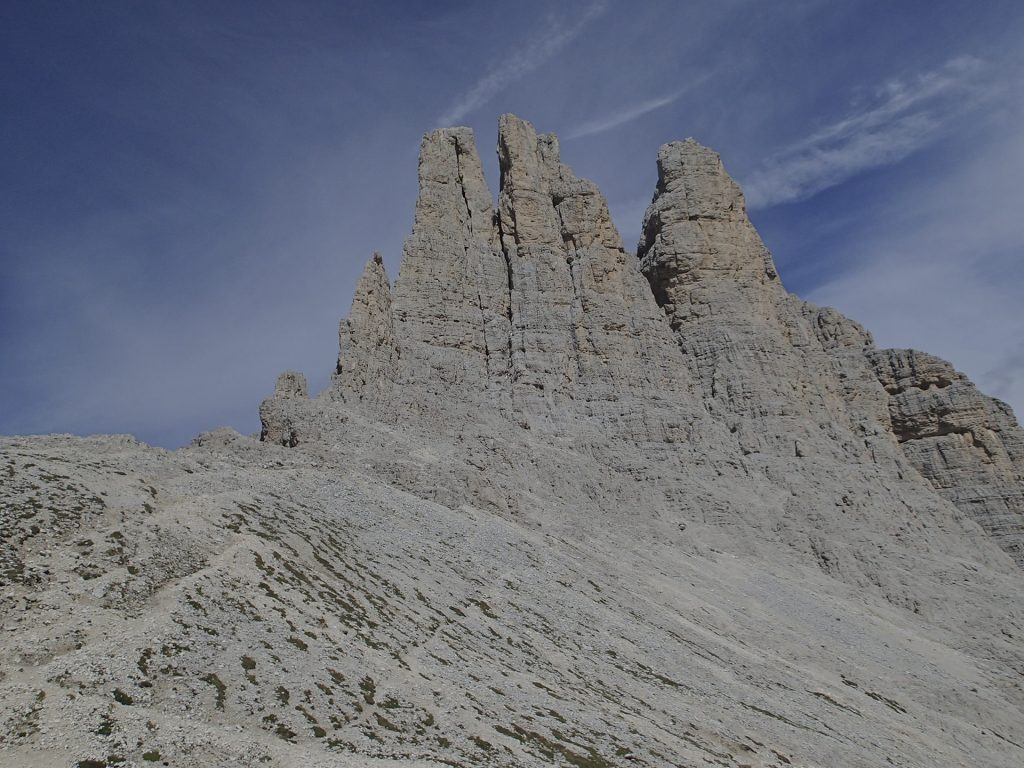
The Rosengarten from Val di Fassa and Val d’Ega
8. Vajolet Towers
About 12 km return, 800 to 1,000 m ascent, 5 hours, moderate to demanding. From Vigo di Fassa, ride the cable car to Ciampedie, walk to Gardeccia, then climb to the SAT-run Rifugio Vajolet. The final section, up steep rock with cables, reaches the small Gartl basin directly under the towers at about 2,600 metres. Many walkers stop at Rifugio Vajolet. From the Val d’Ega side, the Hirzelweg balcony path under the western walls is a gentler option, reached by chairlift from near Passo di Costalunga.
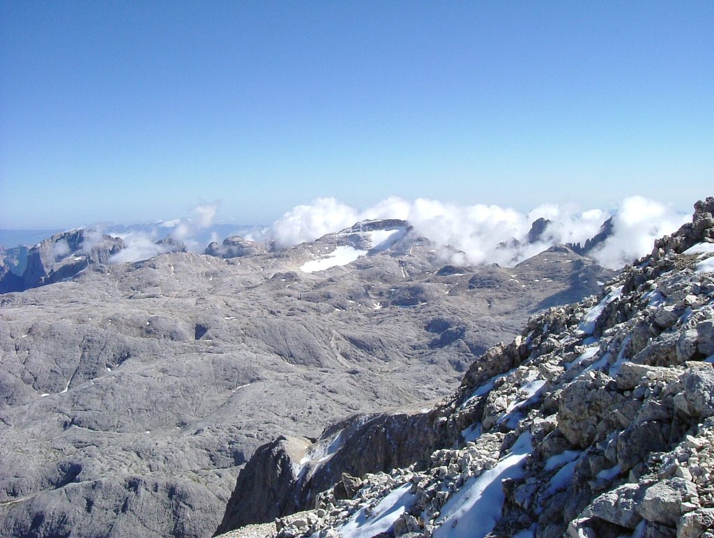
9. Pale di San Martino plateau
2 to 4 hours on the plateau, 150 to 300 m ascent, easy to moderate. From San Martino di Castrozza, a gondola and cable car climb to the Rosetta top station, a quarter of an hour from the SAT’s Rifugio Rosetta at 2,581 metres. Around it lies a bare limestone plateau of about 50 square kilometres, between 2,500 and 2,700 metres. Cima Rosetta, at 2,743 metres, is about 25 minutes from Passo della Rosetta. In cloud the plateau is featureless, so follow the waymarks closely and turn back if visibility drops. Walking all the way down to the village is a long, knee-jarring descent.
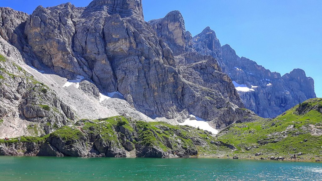
Alta Via 1: an overview
The best-known hut-to-hut route runs for about 120 km from Lago di Braies south to near Belluno, usually over 8 to 12 days. It crosses the Fanes plateau, the First World War tunnels of the Lagazuoi, the Cinque Torri, and the shores of Lago Coldai under the Civetta wall. Most of it is good walking path; the cabled sections near the southern end have alternatives.
The season runs from late June to mid-September. Huts take bookings directly by email, phone or their own websites, and July and August fill months ahead, so plan the route around availability. A short version, from Braies to the Cortina area in four or five days, is a good first taste.
When to go and the weather
Lifts and huts generally open from mid to late June and close between mid and late September. Snow can linger on north-facing passes into early July. September is often the best month: settled weather, thinner crowds, and still most services, though some huts close early. By October the lifts are largely shut.
Summer weather follows a pattern. Mornings tend to be clear, cloud builds over the peaks around midday, and thunderstorms are common from early afternoon, especially in July and August. Check the forecast each morning and turn back early rather than late.
Lifts, passes and rifugio etiquette
Each valley sells its own summer lift tickets and multi-day passes, and some accommodation includes a guest card with free local buses. Check the last descent time before you set off; missing it can mean a long walk down.
- Booking: reserve beds ahead and cancel if plans change; huts keep waiting lists.
- Boots: leave them in the boot room. Many huts provide slippers.
- Bedding: bring a sleeping-bag liner; blankets are provided, sheets often are not.
- Meals: half board is normal, with dinner at a set time. Bring some cash as a backup.
- Waste: carry your rubbish down; water and disposal are expensive at altitude.
Safety on the trail
Italian paths are graded: T is a simple walk, E a normal hiking path, EE for experienced walkers on steep or exposed ground, and EEA for equipped routes needing a via ferrata kit. Nothing in this guide requires a harness, but Sorapis and the Vajolet Towers have cabled sections.
- Emergencies: call 112. The GeoResQ app from the Italian Alpine Club can share your position with rescuers.
- Insurance: helicopter rescue can be charged to the patient, and an EHIC or GHIC does not cover it. Buy travel insurance that names hiking and mountain rescue, or join an alpine club whose membership includes rescue cover.
- Kit: boots with grip, a waterproof, a warm layer, sun cream, two litres of water and a paper map or offline map.
- Plans: tell your accommodation where you are going.
Getting there and around
The nearest major airports are Venice, Verona, Innsbruck and Munich, with Treviso for some budget flights. Trains reach Bolzano, Bressanone, Brunico and Dobbiaco in the north and Calalzo in the south-east, and regional buses continue into the valleys. Summer buses reach most trailheads and passes, which spares you the parking queues.
Plan your trip to Dolomites
- Tickets and tours in Dolomites: tickets and tours on Tiqets · activities on Klook
- Arriving by plane: pre-book an airport transfer with Welcome Pickups
- Road trip: compare car hire on Localrent
- Mobile data: get a travel eSIM from Airalo
Some of these are affiliate links: if you book through them we may earn a small commission, at no extra cost to you.
Planning a bigger trip? See our guide to the 25 best places to visit in Europe, from city breaks to fjords.
Keep exploring
- Hiking in Europe: 10 Outstanding Trails and Destinations
- France’s Most Picturesque Regions: 7 Scenic Bases and Routes
- Europe’s Mountain Ranges Compared: 10 Ranges, Bases and Seasons
Frequently asked questions
What is the best month to hike in the Dolomites?
Early to mid-September for most people: stable weather, open huts and fewer visitors. July has the best wildflowers but more storms; August is busiest.
Do you need to book the Tre Cime toll road?
Yes. Driving to Rifugio Auronzo now needs an online reservation for a time slot, and you cannot buy at the gate. Book early for summer, or walk up from Lago d’Antorno, which needs no reservation.
Can beginners hike in the Dolomites?
Yes. The Alpe di Siusi, the Adolf Munkel Trail, the Cinque Torri and the Seceda loop are all easy, and three of them can start with a lift. Leave the cabled sections and long circuits until you know your pace at altitude.
Photos: Alexander Hoernigk, CC BY 3.0, via Wikimedia Commons; Ximonic (Simo Räsänen), CC BY-SA 4.0, via Wikimedia Commons; Falk2, CC BY-SA 4.0, via Wikimedia Commons; H. Zell, CC BY-SA 3.0, via Wikimedia Commons; Andrea Schieber from München, Deutschland, CC BY-SA 2.0, via Wikimedia Commons; The original uploader was SuperPT at Italian Wikipedia., CC BY-SA 3.0, via Wikimedia Commons; Irene Scarpante, CC BY-SA 4.0, via Wikimedia Commons.