Updated
Scotland’s best scenery rarely comes without a story attached. Stone circles stand beside Orkney lochs, a saint’s monastery faces the Atlantic off Mull, and some of the most famous Highland glens are also the sites of rebellions and a notorious massacre.
This guide covers eight places where history and landscape are equally strong, from Neolithic villages more than 5,000 years old to the moor where the last Jacobite rising ended. They are spread from the Northern Isles to Stirling, so treat it as a menu for a road trip rather than a single route.
Scotland’s historic landscapes at a glance
- Best for: prehistory, Jacobite history, early Christian sites and island scenery.
- When to go: May to September for long days and full ferry timetables; winter for quiet sites and low sun at Maeshowe.
- Getting around: a car is close to essential. Orkney, Lewis and Iona all involve a ferry.
- Book ahead: Maeshowe tours, island car ferries in summer and steam train seats to Glenfinnan.
- Who runs them: mostly Historic Environment Scotland or the National Trust for Scotland, and membership of either covers many entry charges.
1. The Heart of Neolithic Orkney
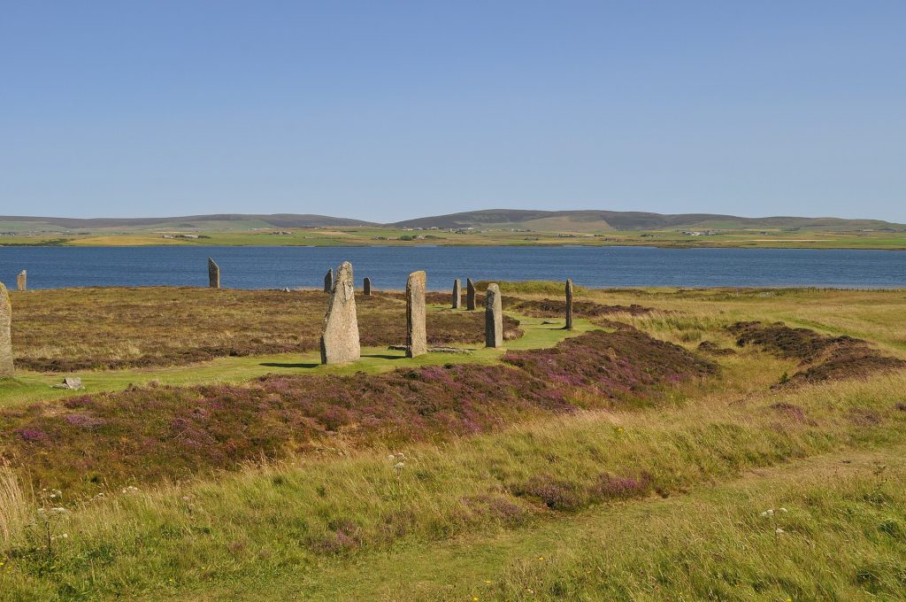
On the West Mainland of Orkney, a cluster of Stone Age monuments was inscribed by UNESCO in 1999 as the Heart of Neolithic Orkney. They lie within a few miles of each other, on low green land between the lochs of Harray and Stenness, and the main group fits into one long day.
Start at Skara Brae on the Bay of Skaill. A storm in 1850 stripped the sand from a mound here and revealed a village of stone houses, occupied from roughly 3180 BC to around 2500 BC. Stone dressers, box beds and hearths survive inside, and the curve of the bay behind makes it one of the finest settings of any prehistoric site in Europe.
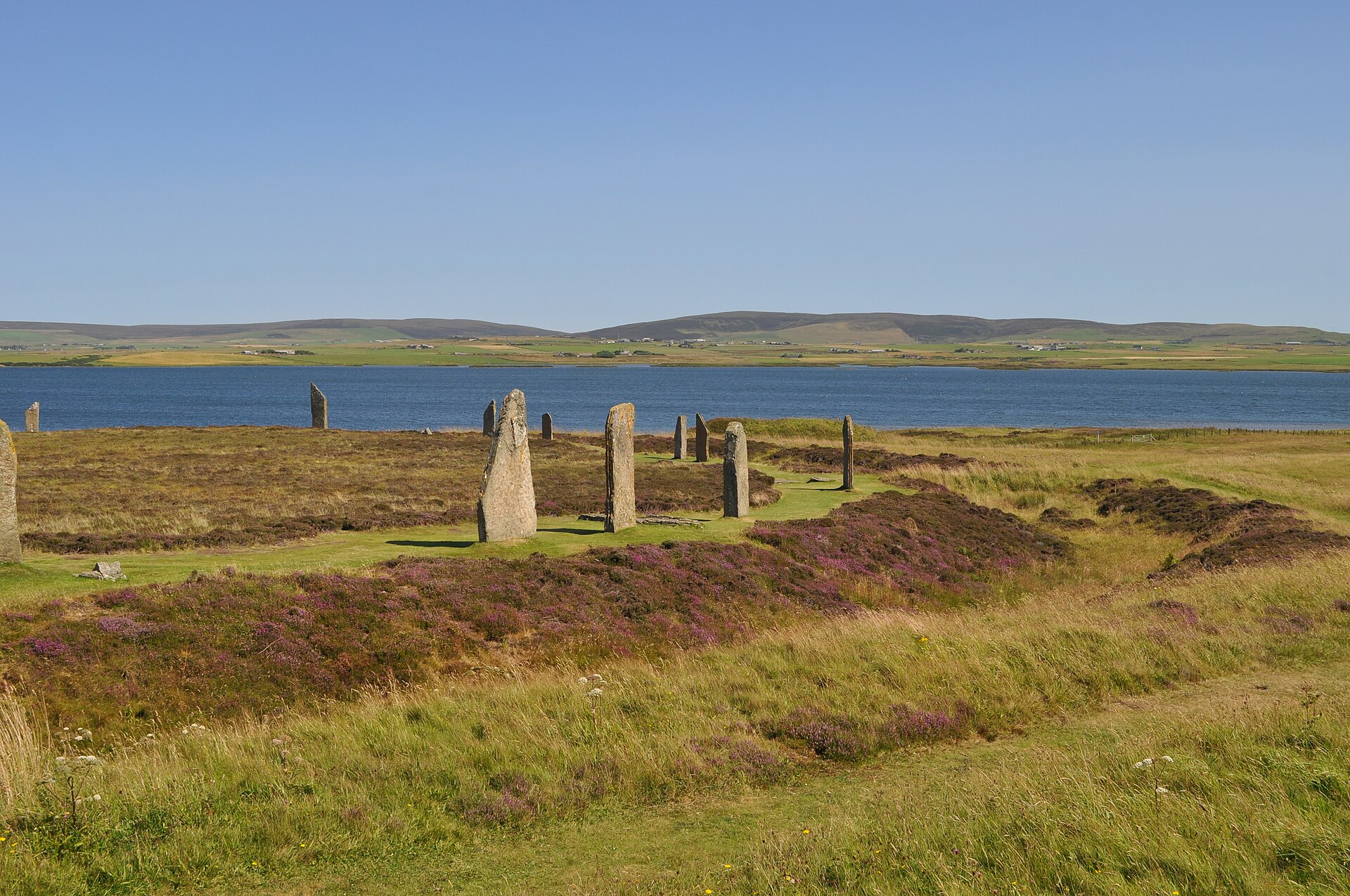
Inland, the Ring of Brodgar is a circle about 104 metres across on a narrow neck of land between the two lochs. It probably had 60 stones; 27 still stand. A short walk south, the Stones of Stenness are fewer but taller, the largest over five metres. Between them lay the Ness of Brodgar, a huge Neolithic complex excavated for two decades and covered over again after the final full season in 2024, so there is little to see there now.
The fourth site is Maeshowe, a chambered cairn whose entrance passage lines up with the setting sun around the winter solstice. Norse visitors broke in during the 12th century and carved runic graffiti that is still legible. Entry is by guided tour only, from the visitor centre at Stenness; groups are small, so book online.
2. Calanais Standing Stones, Isle of Lewis
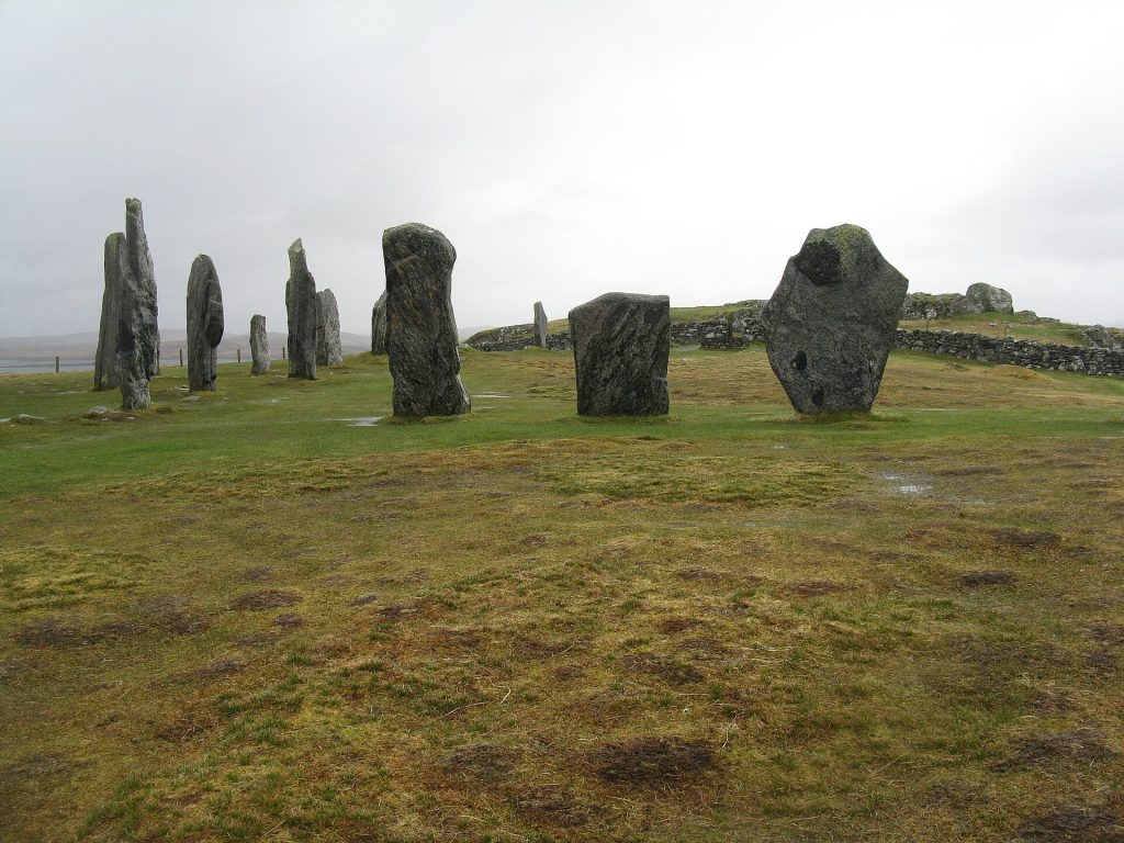
On a low ridge above Loch Roag on the west side of Lewis, the Calanais (Callanish) stones were raised between 2900 and 2600 BC, according to Historic Environment Scotland. A ring of 13 stones surrounds a central monolith about 4.8 metres tall, and rows of stones run out from the circle, giving the monument a rough cross shape from above.
The stones are free and open at all hours, so you can come at dawn or in the long summer twilight, when it is quietest. Several smaller circles stand within sight. The community-run visitor centre reopened in summer 2026 after redevelopment, with a café, shop and new exhibition; it opens Monday to Saturday, 10:00 to 16:00.
Lewis and Harris share one island. South of Tarbert, the west coast of Harris has long white beaches such as Luskentyre and Scarista, which make a natural second day.
3. Kilmartin Glen, Argyll
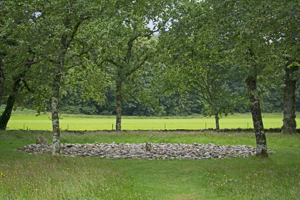
Kilmartin Glen, north of Lochgilphead in mid-Argyll, has one of the densest concentrations of ancient monuments in Scotland: more than 800 recorded within about six miles of the village, around 150 of them prehistoric. Many are signposted from the A816 and linked by short paths across farmland.
The easiest walk joins the Nether Largie standing stones, a line of burial cairns along the valley floor, and the two stone circles at Temple Wood. Cup and ring marks are carved into outcrops on the hillsides.
To the south, Dunadd rises from the flat bog of the Mòine Mhòr. This rocky hill was a royal centre of the early medieval kingdom of Dál Riata, and near the top a footprint carved into the rock is traditionally linked to the making of kings. The climb is short but slippery after rain. Kilmartin Museum, in the village, reopened in 2023 after a major redevelopment and is the best place to make sense of it all.
4. Iona Abbey and the Isle of Iona
Iona is a small, low island off the south-west tip of Mull, with white sand, clear green water and an outsized place in Scottish history. St Columba arrived from Ireland in 563 and founded a monastery that became one of the great centres of early Christianity in these islands. The abbey church you see today is largely medieval, restored in the 20th century.
Beside it, the Reilig Odhrain burial ground is where early Scottish kings are said to lie, and St Martin’s Cross, carved in the 8th century, still stands on its original site outside the abbey.
Visitor cars are not allowed on Iona without a permit. Park at Fionnphort on Mull and take the short passenger ferry. Most people come on a day trip from Oban via Craignure, which is a long day; a night on Mull or Iona makes the visit far calmer.
5. Glenfinnan, Lochaber
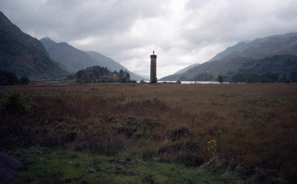
At the head of Loch Shiel, on 19 August 1745, Prince Charles Edward Stuart raised his standard and launched the Jacobite rising. The Glenfinnan Monument, a stone tower topped by the figure of a Highlander, was built in 1815 at the expense of Alexander Macdonald of Glenaladale to mark the event.
Behind the National Trust for Scotland visitor centre, paths climb to a viewpoint over the monument and to the Glenfinnan Viaduct. Built by Robert McAlpine and Sons and opened with the line in 1901, it has 21 arches over about 380 metres, all in unreinforced mass concrete. The Jacobite steam train crosses in summer and ordinary trains all year. The car park fills at steam train times, so arrive early or come by rail.
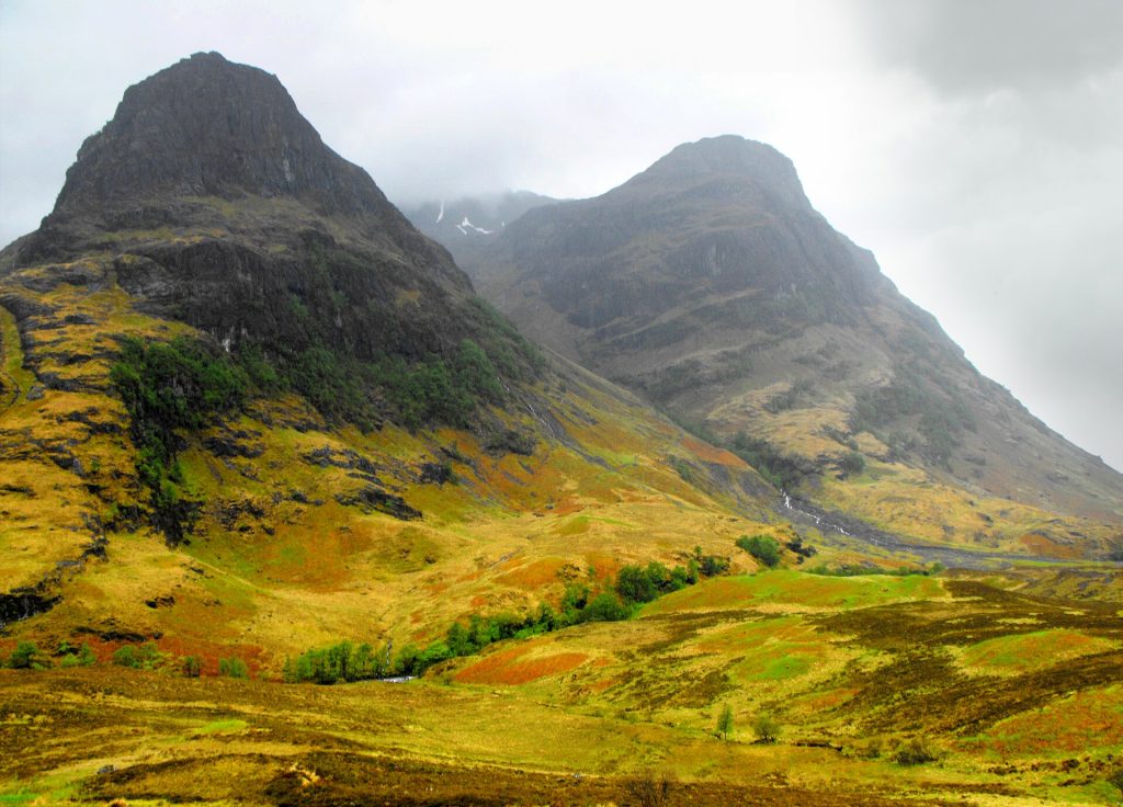
6. Glen Coe and the events of 1692
Glen Coe is known for its mountains, but its human history is just as stark. Before dawn on 13 February 1692, government soldiers under Robert Campbell of Glenlyon, who had been lodged with the MacDonalds of Glencoe, turned on their hosts. The chief, Alasdair MacIain, had been late in swearing the oath of loyalty to William and Mary. Around 30 people were killed, MacIain among them, and others died of exposure after fleeing into the snow.
The massacre became notorious less for its scale than for the breach of hospitality. The National Trust for Scotland visitor centre near Glencoe village tells the story, and a short woodland trail leads to Signal Rock, traditionally linked to that night.
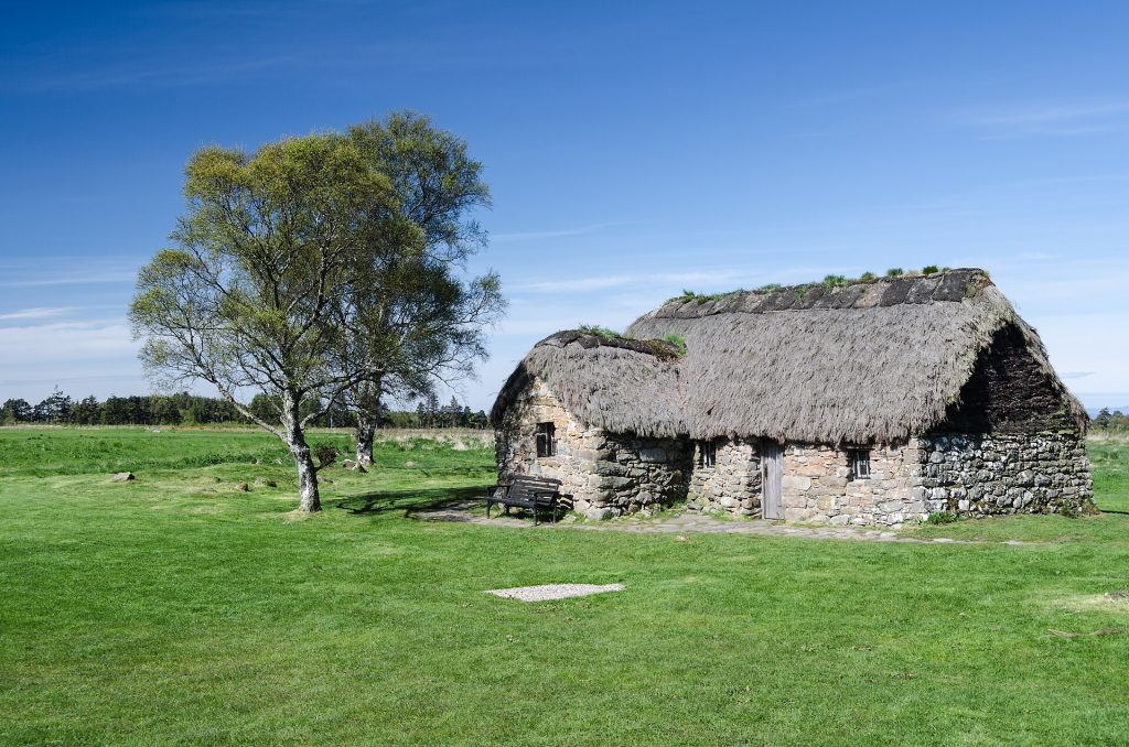
7. Culloden Battlefield and Clava Cairns
East of Inverness, Culloden Moor is where the rising that began at Glenfinnan ended, on 16 April 1746, with the defeat of the Jacobite army by government forces. Its aftermath reshaped the Highlands.
The National Trust for Scotland keeps the moor close to how it looked on the day. Flags mark the two front lines, and stones mark the clan graves. The memorial cairn dates from 1881, and Leanach Cottage, used as a field hospital during the battle, survives as a later rebuild. The visitor centre opened in 2007 and has a roof terrace over the field.
A short drive away, signposted off the B9091 just east of the battlefield, the Clava Cairns are three burial cairns ringed by standing stones in a quiet grove. They are roughly 4,000 years old, free to visit, and a calming contrast with the battlefield.
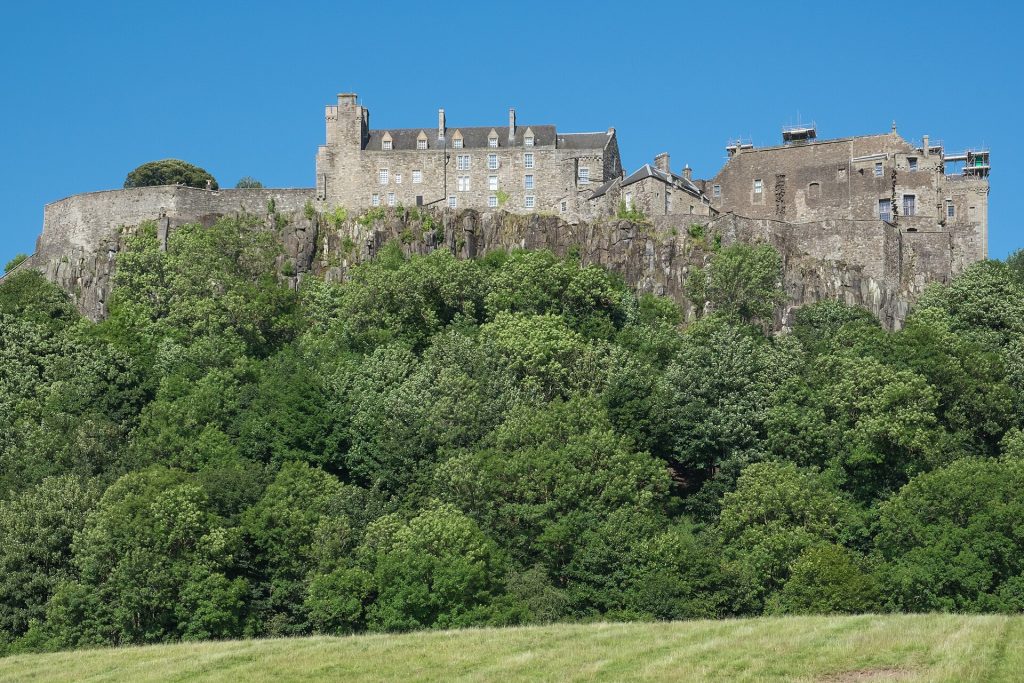
8. Stirling: Castle Rock and the Wallace Monument
Stirling sits where the Highlands meet the Lowlands, and whoever held its crossing of the River Forth held a key to Scotland. Stirling Castle, on a volcanic crag above the old town, was a favoured residence of the Stewart kings, and the restored Great Hall and Royal Palace show how grand it once was.
North-east of the town, the National Wallace Monument stands on the Abbey Craig, where William Wallace is said to have watched the English army before the Battle of Stirling Bridge in 1297. Completed in 1869, it has 246 steps to the top, with views over the loops of the Forth. To the south, Bannockburn is where Robert the Bruce defeated Edward II in 1314.
More if you have time
- Killiecrankie: a wooded gorge just north of Pitlochry and the site of a Jacobite victory in 1689, with riverside paths.
- Jarlshof, Shetland: layered remains of settlements from prehistory to the Norse period, on the shore near Sumburgh.
Planning a route
The sites fall into three groups. Orkney is reached by ferry from Scrabster, Gills Bay or Aberdeen, or by air to Kirkwall, and deserves two full days. Lewis and Harris link by ferry from Ullapool to Stornoway or from Uig on Skye to Tarbert. The mainland sites form one loop: Stirling to Kilmartin, Oban for Iona, then north through Glen Coe and Fort William to Glenfinnan, and up the Great Glen to Inverness and Culloden.
- Ferries: car spaces to the Hebrides sell out in summer, so book as soon as you have dates.
- Weather: exposed sites such as Brodgar, Calanais and Culloden change fast. Pack waterproofs and a warm layer in every month.
- Midges: from late spring to early autumn, bring repellent for the west coast.
- Opening times: staffed sites often keep shorter hours from October to March, so check before driving any distance.
Plan your trip to Scotland
- Tickets and tours in Scotland: tickets and tours on Tiqets · activities on Klook
- Arriving by plane: pre-book an airport transfer with Welcome Pickups
- Road trip: compare car hire on Localrent
- Mobile data: get a travel eSIM from Airalo
Some of these are affiliate links: if you book through them we may earn a small commission, at no extra cost to you.
Planning a bigger trip? See our guide to the 25 best places to visit in Europe, from city breaks to fjords.
Keep exploring
- Scotland’s Most Charming Small Towns: 10 Villages Worth a Night
- Vienna Coffee House Walk: Historic Cafés, Etiquette and What to Order
- Time Travel in Europe: 7 Towns Frozen in a Single Era
Frequently asked questions
What is the oldest historic site in Scotland you can visit?
Skara Brae in Orkney is among the oldest, with houses occupied from around 3180 BC. The Calanais stones and the Ring of Brodgar belong to roughly the same era, the late Neolithic.
Can you see the Maeshowe solstice sunlight?
The low sun lines up with the passage for several weeks either side of the winter solstice, weather permitting. Ask about mid-afternoon tours in December when booking. Cloud often hides it, so treat it as a bonus.
How many days do you need to see these places?
Allow two days for Orkney, two for Lewis and Harris, and five to seven for the mainland loop including Iona. In two weeks, most people combine one island group with the mainland sites.
Photos: Stevekeiretsu, CC BY-SA 3.0, via Wikimedia Commons; M J Richardson, CC BY-SA 2.0, via Wikimedia Commons; Ymblanter, CC BY-SA 4.0, via Wikimedia Commons; Robert Linsdell from St. Andrews, Canada, CC BY 2.0, via Wikimedia Commons; Richard Haworth, CC BY-SA 2.0, via Wikimedia Commons; Florian Fuchs, CC BY 3.0, via Wikimedia Commons; DeFacto, CC BY-SA 4.0, via Wikimedia Commons.