Updated
The lavender fields everyone photographs, on the Valensole plateau and below the abbey at Sénanque, are only part of the story. Most of the true lavender in Provence grows higher up, on the limestone plateaux east of Mont Ventoux, where the villages are smaller, the roads quieter and the flowering later. This guide follows that upland route, from the Plateau de Sault to the hill villages of the Pays de Forcalquier and the edge of the Drôme provençale.
It works best as a three or four day drive with two bases. Valensole, Gordes and the Luberon, covered elsewhere on our site, get a short mention near the end.
The upland lavender route at a glance
- Best for: fine lavender, quiet hill villages, slow driving and cycling.
- When to go: typically early to late July on the high plateaux; late June to mid-July lower down.
- Bases: Sault for the Ventoux side, Forcalquier or Banon for Haute-Provence, Montbrun-les-Bains for the Drôme.
- Getting there: a car is close to essential; Avignon, Marseille and Manosque are the usual starting points.
- Allow: three days for the core loop, four or five with the Drôme and the Luberon.
- Remember: the fields are working farmland, so look and photograph from the edges.
1. Sault and the Plateau de Sault
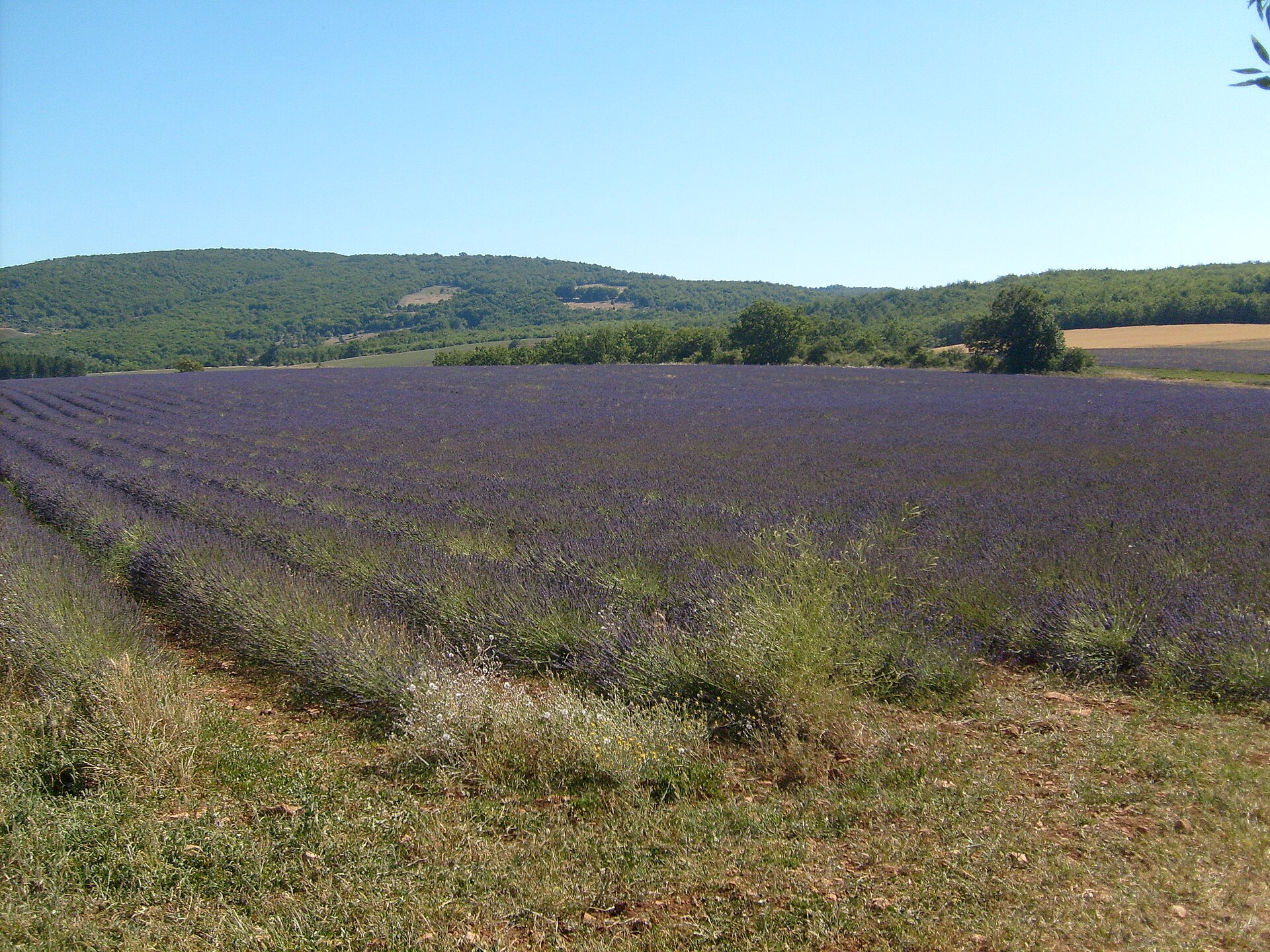
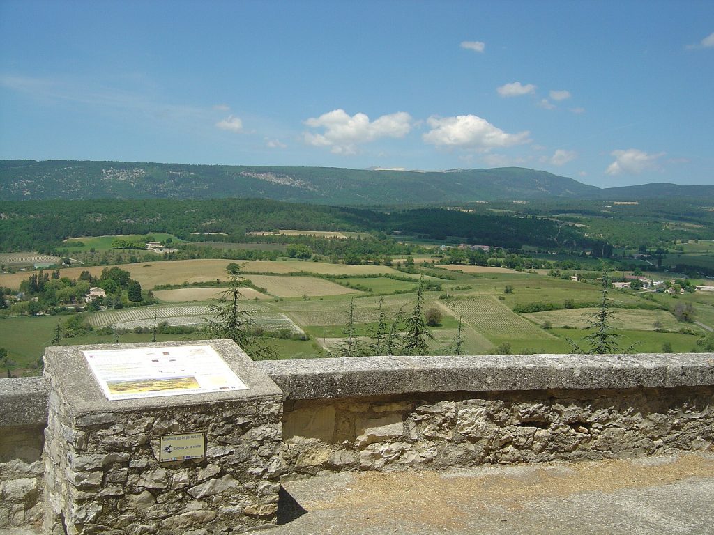
Sault is the natural start. The village stands on a rocky spur at around 765 metres, with the plateau spread out below it in strips of lavender, spelt and wheat, and Mont Ventoux rising to the north-west. The cooler, higher ground suits fine lavender, Lavandula angustifolia, and the Pays de Sault is usually described as its main growing area in Provence.
The village is compact and unpretentious, with a few streets of shops selling lavender products, honey and nougat, and viewpoints on the edge of the old centre over the fields. The small roads that leave Sault in every direction, towards Saint-Trinit, Aurel and Monieux, are where you will find the best fields, often edged with dry-stone walls.
2. Monieux and the Gorges de la Nesque
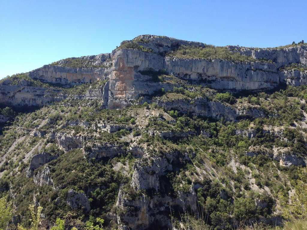
South-west of Sault, the small village of Monieux sits beside a lake at the top of the Gorges de la Nesque, a limestone canyon cut by the river of the same name. The D942 follows the north side of the gorge for around 20 km to Villes-sur-Auzon, through short tunnels and past several lookouts. The best known is the Belvédère du Castelleras, which faces the Rocher du Cire, a sheer cliff on the opposite side.
It is a slow, winding road, popular with cyclists, and a scenic way in or out of the plateau from Carpentras.
3. Aurel, Ferrassières and the Ventoux foothills
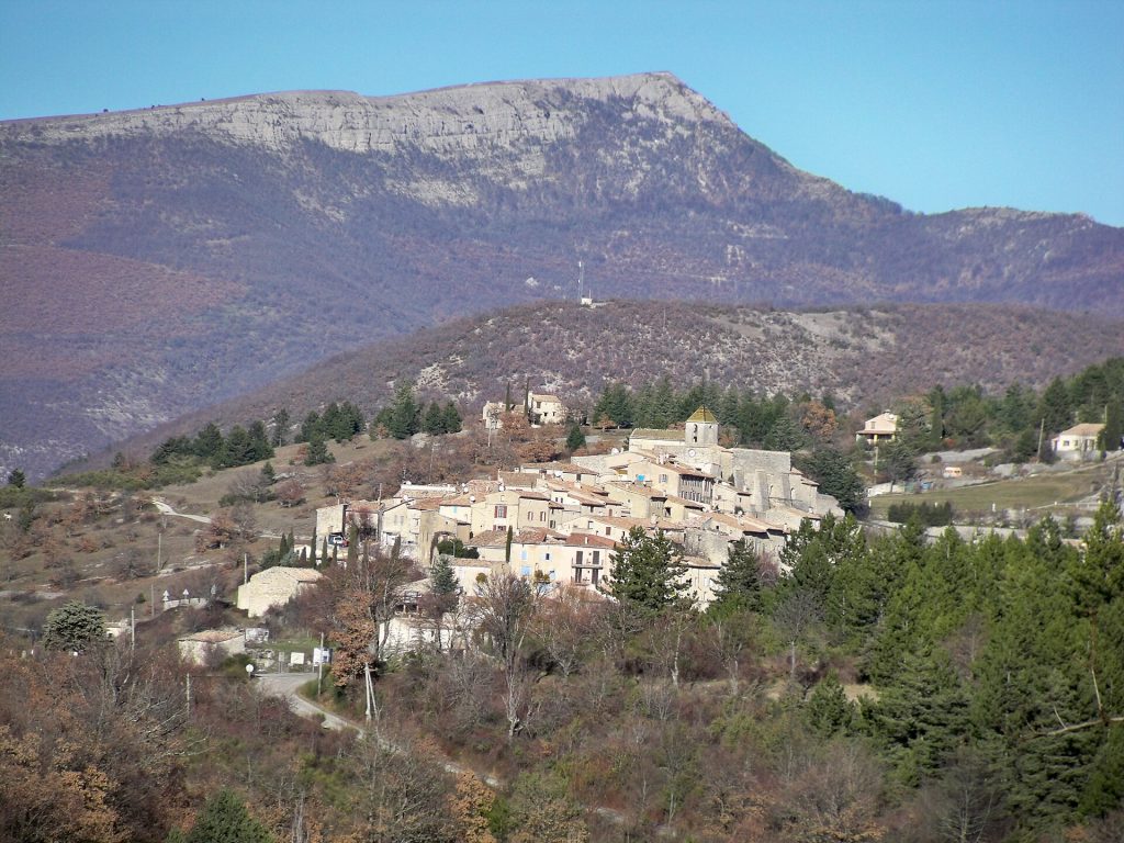
Five kilometres north of Sault, Aurel is a tiny perched village on a spur at the foot of the Ventoux, with a church at the top and lavender fields running right up to its lower houses. The lanes around it are among the most photogenic on the route, with the pale summit behind the rows.
Continue north-east and you cross into the Drôme department at Ferrassières, a scattered village at roughly 1,000 metres on the northern rim of the Plateau d’Albion. It holds a small lavender fair, usually on the first Sunday of July; check current dates locally.
For the big view, drive the D164 from Sault up Mont Ventoux (1,910 metres). Above the Chalet Reynard the slopes turn to bare white scree, and on a clear morning you look back over the whole plateau. Expect heavy cycle traffic.
4. The Plateau d’Albion
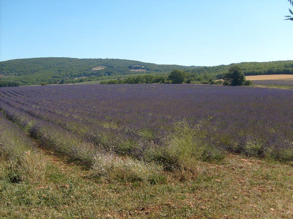
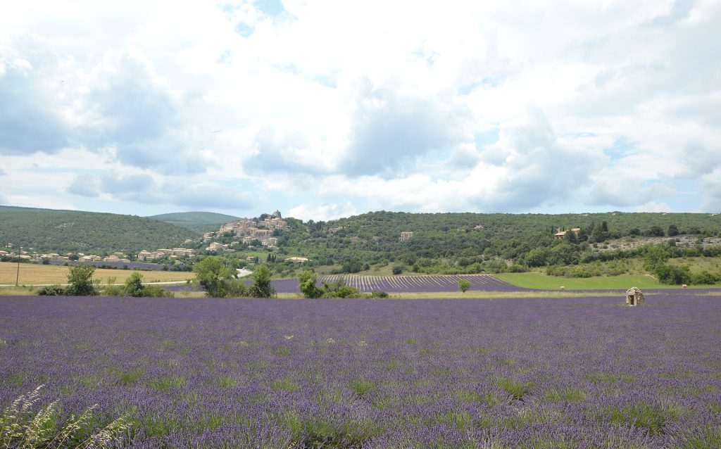
East of Sault, the land rises into the Plateau d’Albion, a wide, open upland of lavender, cereals and scrub oak shared between Vaucluse, the Drôme and the Alpes-de-Haute-Provence. Saint-Christol, Lagarde-d’Apt and Revest-du-Bion are small farming villages rather than sights, and the plateau feels empty in a way the Luberon rarely does. Flowering tends to run later than on lower ground, so in a typical year it is still in colour when parts of Valensole have been cut. It is good cycling country, with gentle gradients, little traffic and almost no shade.
5. Simiane-la-Rotonde
On the south-eastern edge of the plateau, Simiane-la-Rotonde is the most striking village on this route. Its houses climb a steep hill to the Rotonde, the round 12th-century keep of the former castle, which has a domed interior ringed with carved capitals and has been a listed historic monument since 1841. Lavender fields wrap around the foot of the hill.
The Rotonde is open to visitors in season, and in August it hosts Les Riches Heures Musicales de la Rotonde, a festival of early music with concerts inside the keep. Check current dates.
6. Banon
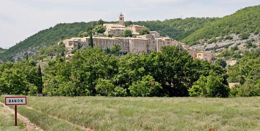
Banon, about 20 minutes north-east of Simiane, is a working market village at around 760 metres, between the Montagne de Lure and the Luberon hills. The quiet old upper village is reached through a fortified gateway; the shops and cafés are in the lower town.
The village gives its name to Banon, a small raw goat’s milk cheese wrapped in brown chestnut leaves and tied with raffia. It has had protected status since 2003, and Banon makes a good base for Simiane and the Plateau d’Albion.
7. Forcalquier and Lurs
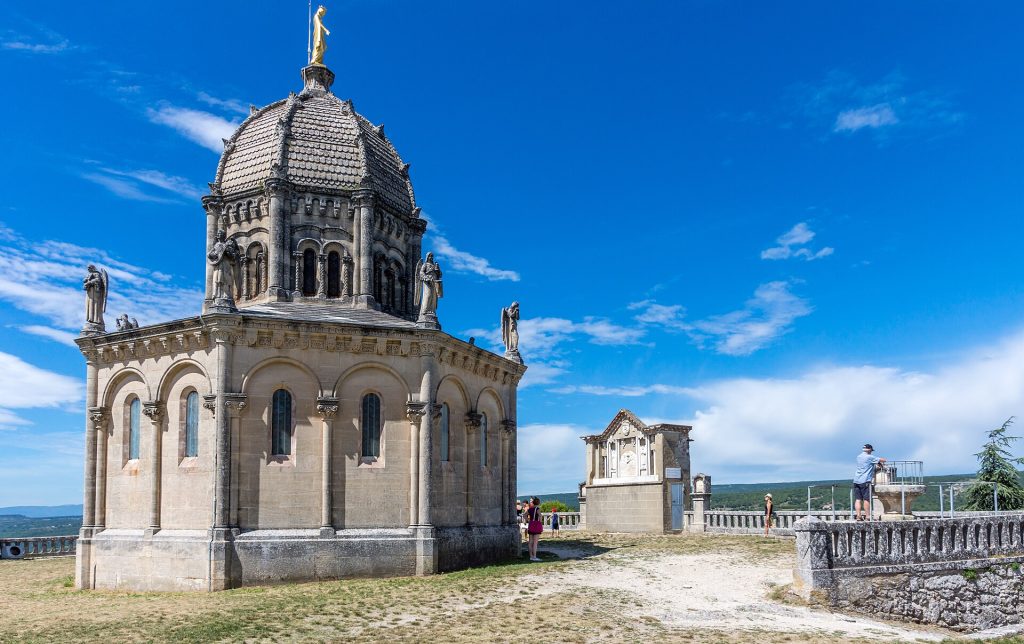
Forcalquier is the largest town on the route and the most practical base on the Haute-Provence side, with a big Monday morning market. Climb the citadel hill, where the 19th-century chapel of Notre-Dame-de-Provence stands on the site of the counts’ castle, for a wide panorama.
A short drive south-east, Lurs is a small perched village on a ridge above the Durance valley, with views across to the Valensole plateau. It hosts the Rencontres de Lure, an annual gathering on typography and graphic design held in late August. Valensole is less than an hour away across the river; our photo spots guide covers it.
8. Montbrun-les-Bains and the Drôme provençale
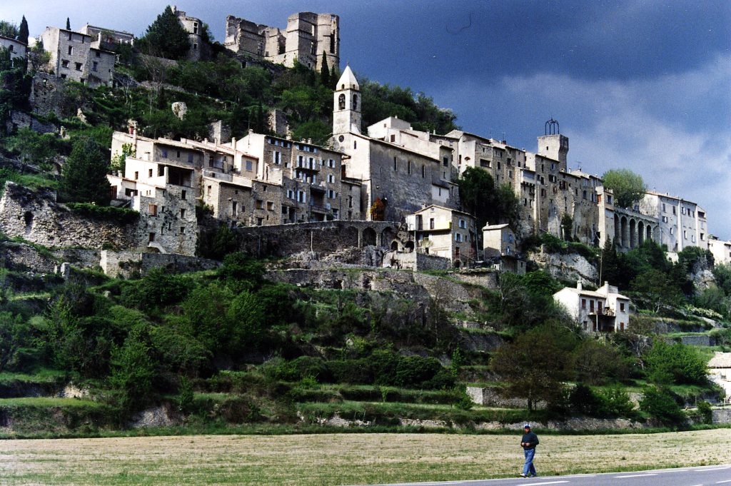
North of Aurel, the road drops into the Drôme provençale and the Baronnies Provençales regional nature park. Montbrun-les-Bains, one of the Plus Beaux Villages de France, stacks its tall houses up a hillside facing a small lavender plain and the north face of Mont Ventoux. It is also a spa town fed by sulphurous springs, and usually holds a lavender festival in July.
The wider Drôme provençale is the classic alternative to Valensole, with lavandin around Grignan, Valréas and the Tricastin flowering earlier than the uplands; our off the beaten path guide covers that side, along with Nyons.
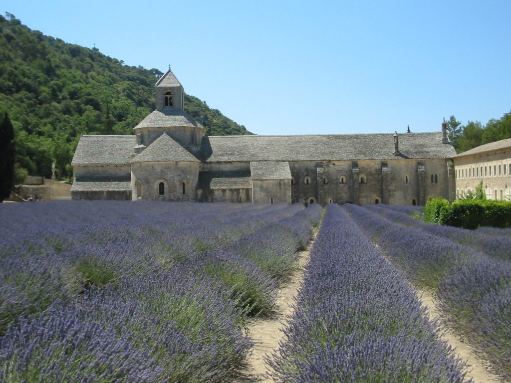
The Luberon classics in brief
Sénanque Abbey, in a narrow valley north of Gordes, was founded by Cistercian monks in 1148 and is still home to a monastic community; you can see the fields in front of the church from outside, while visits to the interior are by ticket and should be booked. Gordes is the famous tiered hill village, and Roussillon is built among red and orange ochre cliffs. Lavender here usually flowers earlier, and crowds are far heavier.
Lavandin or fine lavender: how to tell them apart
Much of what visitors call lavender in Provence is in fact lavandin, a natural hybrid of fine lavender and spike lavender. Lavandin is sterile, so it is propagated from cuttings, and it yields far more oil per hectare, which is why it covers the lower plateaux such as Valensole. The plants are larger and rounder, with longer, pointed flower heads and a sharper, camphor-like scent.
Fine or true lavender is smaller and more compact, with shorter flower spikes and a softer scent. It is grown mainly on the higher ground, and essential oil sold under the AOP Huile Essentielle de Lavande de Haute-Provence label must come from fine lavender grown at altitude within a defined area.
When the lavender flowers
Timing depends on altitude and on the weather each spring, so treat any calendar as a guide. In a typical year, lavandin on the lower plains of the Drôme and the Luberon starts colouring in mid to late June. Valensole is usually at its best in late June and early July. The high fields around Sault and on the Plateau d’Albion tend to peak through July, often into the last week of the month.
Harvesting starts from around mid-July on the lower ground and moves uphill through late July and into August. Farmers cut when the oil is right, and in a hot summer a field can turn to stubble within days. The Sault lavender festival is usually held on 15 August, with a sickle-cutting contest and a producers’ market; by then many fields have been harvested, so go for the event rather than the colour, and check current dates.
Field etiquette
- Stay out of the rows: almost every field is private farmland. Walking between the plants damages them and is the main complaint from growers.
- Do not pick: buy a bunch at a stall or market instead.
- Park properly: use lay-bys and village car parks, never field entrances or tractor tracks, which are in use during harvest.
- Mind the bees: fields are full of them.
- Drones: do not assume you can fly one; French rules apply, and farmers may object.
- Respect signs: some growers set aside a field for photographs; use those where they exist.
Getting there and getting around
Avignon, with its TGV station and airport, is the usual gateway for the Ventoux side; Sault is a drive of roughly an hour and a half, via Carpentras, with the Gorges de la Nesque as the scenic option for the final stretch. Marseille airport is better placed for Forcalquier and Banon, and Manosque, on the regional rail line from Marseille, is the nearest station to the Haute-Provence end. Buses on the plateaux are sparse, so a car is the practical choice.
A comfortable plan is two nights in Sault, covering Monieux, Aurel, the Ventoux and Montbrun-les-Bains, then two nights in Forcalquier or Banon for Simiane, Lurs and the Plateau d’Albion. Book early for July and carry water.
Plan your trip to Provence
- Tickets and tours in Provence: tickets and tours on Tiqets · activities on Klook
- Arriving by plane: pre-book an airport transfer with Welcome Pickups
- Road trip: compare car hire on Localrent
- Mobile data: get a travel eSIM from Airalo
Some of these are affiliate links: if you book through them we may earn a small commission, at no extra cost to you.
Planning a bigger trip? See our guide to the 25 best places to visit in Europe, from city breaks to fjords.
Keep exploring
- Les Baux-de-Provence Guide: Castle, Quarry Light Show and Alpilles
- Europe’s Ancient Paths: 7 Old Routes to Walk in Quiet Sections
- Europe’s Best Campervan Road Trips: 7 Routes and Where to Sleep
Frequently asked questions
When is the best time to see lavender in Provence?
Typically from late June to late July. Go in late June or the first days of July for the Luberon, Valensole and the Drôme plains, and in mid to late July for Sault and the Plateau d’Albion. Timing varies each year.
Can you walk in the lavender fields?
Not between the rows. The fields are private working farms, and walking through them damages the plants. Photograph from the edge or a track.
Is Sault or Valensole better for lavender?
Valensole has the larger, flatter fields, mostly lavandin, and flowers earlier, but it is very busy at peak season. Sault has smaller fields of fine lavender among hills and villages, flowers later and is quieter. If you visit in mid to late July, the Sault area is the safer bet.
Photos: Greg marguerittes, CC BY-SA 3.0, via Wikimedia Commons; Anthospace, CC BY-SA 4.0, via Wikimedia Commons; erikorama, CC BY 2.0, via Wikimedia Commons; Véronique PAGNIER, CC0, via Wikimedia Commons; Marianne Casamance, CC BY-SA 3.0, via Wikimedia Commons; Jean-Marc Rosier ( http://www.cjrosier.com + http://www.gordes-immobilier.com ), CC BY-SA 3.0, via Wikimedia Commons; Jean-Christophe BENOIST, CC BY 3.0, via Wikimedia Commons; PhillipC, CC BY 2.0, via Wikimedia Commons; Brice, CC BY-SA 3.0, via Wikimedia Commons.